
Turning houses
|
Turning houses
Rural community of Südeichsfeld
Coordinates: 51 ° 9 ′ 40 ″ N , 10 ° 15 ′ 0 ″ E
|
|
|---|---|
| Height : | 286 (280-290) m |
| Incorporation : | April 21, 1995 |
| Incorporated into: | Katharinenberg |
| Postal code : | 99988 |
| Area code : | 036024 |
 Location of Wendehausen in Südeichsfeld
|
|
 View of the place from the north
|
|
Wendehausen is a district of the rural community of Südeichsfeld . It is located in the Unstrut-Hainich district in Thuringia and has around 860 inhabitants.
Geographical location
Wendehausen is considered the southernmost village of the Upper Eichsfeld . The village is located in the Eichsfeld-Hainich-Werratal Nature Park in the narrow valley of the Haselbach (Heldrabach), a right tributary of the Werra . The environment is characterized by a low mountain range and the Werra valley. The predominant type of rock is shell limestone , in which the hazel river has dug itself deep. To the west of the town extends - up to the Hessian-Thuringian border - the Treffurt city forest , a contiguous deciduous forest area of around 6 km², which belonged to the city of Treffurt until the 1960s. The highest elevation is the Karnberg (approx. 461 m above sea level ) located about 2 km to the northwest , further elevations are the Fritzeberg ( 411 m above sea level ), Ziegenberg ( 395 m above sea level ) and Mühlberg ( 391 m above sea level) ).
history
Wendehausen was mentioned in a document in a truce from 1333. Wendehausen belonged to the former Ganerbschaft Treffurt until 1802 , one third of which belonged to the Archbishop of Mainz, the Saxon Electors and the Hessian Landgraves of Hesse-Kassel . Wendehausen was owned by the Archbishops of Mainz and, in contrast to the other areas of the Ganerbschaft, remained Catholic.
The local attractions include the Bonifatius Church, built in 1720, and the Bonifatiusbrunnen, where Bonifatius himself should have baptized new converts. There were two mills in Wendehausen. The lower mill was in operation until 1952, then the mill wheel broke and had to be dismantled. In their place today there is a modern residential building. The upper mill was built in 1845 and a power generator was installed in 1911. In 1977 the mill wheel was dismantled to widen the road, and in 1979 the grinding operation, which could initially be continued with an electric grinder, was finally stopped.
Wendehausen had a stop on the Vogteier Bimmelbahn , which was a railway line that connected the place with the neighboring cities of Mühlhausen , Treffurt and Wanfried . The line started operating in 1911. From 1952, the Treffurt station was no longer served. Freight traffic to the terminus in Normannstein was in operation until 1960 , where the Wendehouses quarry with its attached concrete works had to be served. In passenger traffic, the line was in operation until September 29, 1968 to Wendehausen. The Treffurt-Heyerode section has been redesigned as a railway cycle path , the route is part of the Unstrut-Werra cycle path. The former border strip is placed under nature protection as part of the biotope network Green Belt Germany .
With effect from June 3, 1964, the Erfurt District Assembly approved the incorporation of the Kleintöpfer district with the destroyed small settlement Karnberg , City of Treffurt, with an area of 599.8,586 hectares in the Wendehausen community, Mühlhausen district. To Wendehausen also the result of including the German division of the abgesiedelte Good crowd flea and two surviving medieval deserted villages there (Grünrode and Sifterode).
On April 21, 1995, Wendehausen was incorporated into the new Katharinenberg community. With its dissolution, the place came to the rural community of Südeichsfeld on December 1, 2011.
Desolation

The following desolations are located in the municipality of Wendehausen:
- Kleintöpfer : Desolation since 1964 (Kleintöpfer only came from Treffurt to Wendehausen in 1964)
- Vorwerk Karnberg : Desertification since 1952 (Karnberg only came to Wendehausen municipality in 1964 with Kleintöpfer)
- Gut Scharfloh : Desertification since 1972
- Grünrode: The place was between Katharinenberg and the state border with Hesse south of the federal highway 249 , on the opposite side of the valley was the place Kesslingerode (belonging to Hildebrandshausen) and today also a desert. When Grünrode was first mentioned in 1581, it was already a desert. Landgrave Wilhelm von Hessen hands over 4 Hufen land to the municipality of Wendehausen and enfeoffs them with a third of the desert. After 1603 Wilhelm von Harstall received 3 hooves in Grünrode from the Elector of Mainz. The place was administered by the Mainz Vogt in Treffurt . Around 1900 the following parcels were known in the local area of Grünrode: Herberskopf, an der Linde, Scherfeld, am Busche, Möhntal, Schafäsch, Dreissigacker.
- Sifterode: The former village was on the border of the municipal markings Wendehausen, Katharinenberg and Diedorf. In 1407 the Stift Großburschla enfeoffed an Eckard stone house with three parts from Siebolderode and the Spitelsgut Scharfloh (Spitalgut?). In 1536 Kaspar von Harstall sold his share in the Sibolderode desert and the Spitelsgut. In 1611, the Petersstift in Erfurt enfeoffed Wilhelm von Harstall with the desert.
Kleintöpfer, the Vorwerk Karnberg and Gut Scharfloh were evacuated and demolished due to the close proximity to the inner-German border. On a historical border map from the end of 1585, Gut Scharfloh is listed with buildings and Grünrode without buildings is still known as a desert. Wendehausen and both places were assigned to the area of Treffurt and did not belong to the historical Eichsfeld. The place Sifterode is no longer shown on the map and was probably no longer known at the time the map was created. The large forest area of the Karnberg is marked as Wanfrieder Holz.
coat of arms
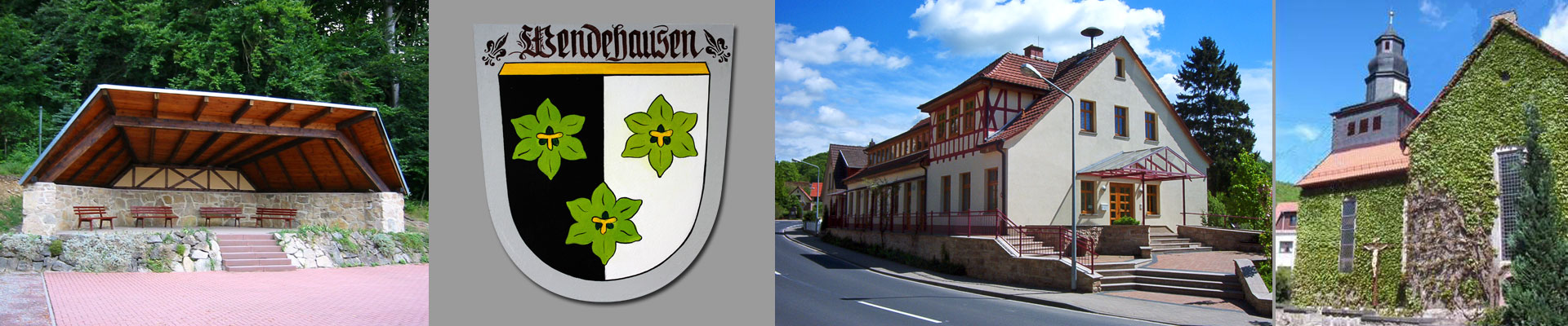
The Wendehäuser coat of arms shows three green watercress leaves on a black and white background. Black and white, the Prussian colors, were probably chosen because Wendehausen had belonged to Prussia since 1802. In the foreground are three green watercress leaves - in Eichsfeld dialect "Bornkärschen".
Watercress, the “vegetable of the poor people”, was grown and harvested in earlier times in the source streams and tributaries of the Haselbach and in the storage areas of the mill wheels. This gave the turning houses the nickname "Wengehisser Bornskärschen". Teacher Otto Mehler wrote in 1956: “There was a large pond near the Obermühle, surrounded by a row of stately birch trees. Watercress was sown at the bottom of the 50 cm deep water. The water had to be drained off and fresh water supplied at certain intervals. After a while, delicate green looked up at the water level. Women kneeling on small wooden benches cut off the young cress. The harvest was brought to the nearby cities in baskets. There was already a little bundle for a silver groschen. Did you think of the arduous work of the Wendehaus women while eating the delicious salad dish? Even today some people fish for the lush green on the Mühlbach, but no longer to enrich other people's tables. The cress pond has long since disappeared from the village landscape, but the nickname "Wengehisser Bornskärsche" has remained. "
Religions
80 percent of the residents of Wendehausen are Roman Catholic.
Personalities
- Johannes Creutzburg (1686–1738), master organ builder in Central Germany during the Baroque period
politics
The town mayor is Frank Peterseim (election on September 22, 2013). The local council (election on September 22, 2013) consists of the following people: Bertram Müller (deputy), Renate Döring, Marcel Degenhardt, Karl-Josef Montag, Wilfried Höppner and Stefan Montag
Town twinning
Wendehausen has had a partnership with the French town of Tillières-sur-Avre for many years . The German-French Circle of Friends of Wendehausen shows particular commitment . This organizes meetings between the two communities every year.
Worth seeing

Sights in and around Wendehausen include:
- St. Boniface Church
- Boniface fountain
- Freilandkreuzweg
- Katharinenberg border tower and border tower on the Karnberg
- Border lock on the Mainz heads
societies
Numerous associations shape the cultural life in the community. Over 600 members are involved in different ways:
- SG Eintracht Wendehausen
- Wendehausen Fire Brigade Association
- Rifle Club 1871 Wendehausen eV
- Franco-German Circle of Friends
- Carneval club Wendehausen
- Heimatverein Wendehausen
- Heuberg musicians
- Youth club
- Men's Choir 1897 eV
- Open Air GbR Wendehausen
- Seniors Association
- Kirmesverein Wendehausen
Web links
Individual evidence
- ^ Conrad Zehren : The introduction of Christianity on the Eichsfelde by St. Boniface. Kirchheim, Schott and Thielemann, Mainz 1847, p. 124 .
- ↑ Volker Große, Klaus Herzberg: Obermühle / Untermühle Wendehausen. In: Volker Große, Klaus Herzberg: Mills in the Obereichsfeld. A compendium. Eichsfeld-Verlag, Heiligenstadt, 2008, ISBN 978-3-935782-13-5 , pp. 350–351.
- ↑ Border hiking trail in the Wartburg region - Treffurt. (No longer available online.) In: Wartburgkreis-Online. Archived from the original on August 3, 2012 ; Retrieved February 22, 2010 .
- ^ Gerhard Günther: On the territorial development of the Mühlhausen district . In: Mühlhauser contributions to history and cultural history . Issue 2, 1979, ZDB -ID 14566-X , p. 64-70, 127-128 .
- ↑ TK25 - sheet 4827 Treffurt
- ↑ StBA: Changes in the municipalities of Germany, see 1995
- ↑ Levin von Wintzingeroda-Knorr : Die Wüstungen des Eichsfeldes: Directory of the desert areas, prehistoric ramparts, mines, courts of law and waiting areas within the districts of Duderstadt, Heiligenstadt, Mühlhausen and Worbis. O. Hendel, Göttingen 1903, p. 504
- ↑ Levin von Wintzingeroda-Knorr : Die Wüstungen des Eichsfeldes: Directory of the desert areas, prehistoric ramparts, mines, courts of law and waiting areas within the districts of Duderstadt, Heiligenstadt, Mühlhausen and Worbis. O. Hendel, Göttingen 1903, p. 935
- ↑ Coat of arms on the rural community of Südeichsfeld