
Burgwalde
| coat of arms | Germany map | |
|---|---|---|

|
Coordinates: 51 ° 23 ' N , 10 ° 3' E |
|
| Basic data | ||
| State : | Thuringia | |
| County : | Eichsfeld | |
| Management Community : | Hanstein-Rusteberg | |
| Height : | 255 m above sea level NHN | |
| Area : | 4.96 km 2 | |
| Residents: | 226 (Dec. 31, 2019) | |
| Population density : | 46 inhabitants per km 2 | |
| Postal code : | 37318 | |
| Area code : | 036083 | |
| License plate : | EIC, HIG, WBS | |
| Community key : | 16 0 61 021 | |
| LOCODE : | DE GPW | |
| Association administration address: | Steingraben 49 37318 Hohengandern |
|
| Website : | ||
| Mayor : | Rainer Lott | |
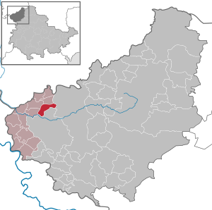
| Location of the municipality of Burgwalde in the Eichsfeld district | ||
  |
||

Burgwalde is a municipality in the Thuringian district of Eichsfeld and belongs to the Hanstein-Rusteberg administrative community .
geography

Burgwalde is located about 6 km northwest of the district town of Heiligenstadt . The location is in the red sandstone hill landscape of the middle Eichsfeld . The Schwobach flows through the village and joins the Leine at Schönau to the south . The federal motorway 38 runs immediately to the north with a junction at Arenshausen .
history
Burgwalde was first mentioned in a document in 1318 as bortwold . The name is a Low German name for a border forest.
Population development
Development of the population (as of December 31st):
|
|
|
|
|
- Data source: Thuringian State Office for Statistics
coat of arms
Blazon : “In red with a golden border, a golden knight on an erect golden-bridled silver horse, with the silver flag with a red high cross killing a black dragon. "
politics
Municipal council
The municipal council of Burgwalde consists of six council members.
- Election proposal fire brigade e. V .: 2 seats
- Nomination for the home club: 2 seats
- Nomination for boys' association: 2 seats
(As of: local elections on May 25, 2014)
mayor
The mayor Rainer Lott was elected on October 6, 2013.
Attractions

- Catholic St. George's Church from the beginning of the 18th century with a particularly valuable altar. Since 2000 there has been a photovoltaic system on the tiles of the roof of the listed (solar) church . This brings in 50 euro cents per kilowatt hour brought into the public grid. In the first 9 years, 20,000 kWh were fed in.
- Stationsweg and Bonifatius Chapel on the Brink (296 m)
- Mariengrotte at Kessenberg (278 m)
literature
- Guido Osburg: Burgwalde im Eichsfeld - Festschrift for the 700th anniversary . Ed .: Council of the community. Burgwalde 2018, p. 317, A4 format .
Individual evidence
- ^ Population of the municipalities from the Thuringian State Office for Statistics ( help on this ).
- ↑ Erhard Müller: The place names of the district of Heiligenstadt. Heilbad Heiligenstadt 1989, p. 13
- ^ Municipality: Burgwalde. Thuringian State Office for Statistics. On Statistics.Thueringen.de, accessed on December 29, 2019.
- ↑ 2014 municipal council elections in Thuringia - final result. Thuringian State Office for Statistics, accessed on December 29, 2019 .
- ↑ Mayoral elections in Thuringia. Thuringian State Office for Statistics, accessed on December 29, 2019 .
- ↑ Parishes for solar energy. Leaflet of the German Federal Environment Foundation (BDU).
- ↑ https://www.tlz.de/web/zgt/suche/detail/-/specific/Wohnstaetten-in-Burgwalde-als-Spiegel-der-Geschichte-561736192 - accessed on September 18, 2018
Web links
At the Ohmberg | Arenshausen | Asbach-Sickenberg | Berlingerode | Birkenfelde | Bodenrode-Westhausen | Bornhagen | Brehme | Width worbis | Buhla | Burgwalde | Büttstedt | Dieterode | Dietzenrode / Vatterode | Dingelstädt | Ecklingerode | Effelder | Eichstruth | Ferna | Freienhagen | Fretterode | Geisleden | Geismar | Gerbershausen | Gernrode | Glasehausen | Großbartloff | Haynrode | Heilbad Heiligenstadt | Heuthen | Hohengandern | High cross | Kella | Kirchgandern | Kirchworbis | Krombach | Küllstedt | Leinefelde-Worbis | Lenterode | Lindewerra | Lutter | Mackenrode | Marth | Lower Orschel | Pfaffschwende | Reinholterode | Rohrberg | Röhrig | Rustenfelde | Schachtebich | Schimberg | Schönhagen | Schwobfeld | Sickerode | Sunstone | Steinbach | Steinheuterode | Keyings | Services | Thalwend | Uder | Volkerode | Waxed | Wahlhausen | Blowing | Wiesenfeld | Wingerode | Wüstheuterode