Uder
| coat of arms | Germany map | |
|---|---|---|

|
Coordinates: 51 ° 22 ' N , 10 ° 4' E |
|
| Basic data | ||
| State : | Thuringia | |
| County : | Eichsfeld | |
| Management Community : | Uder | |
| Height : | 230 m above sea level NHN | |
| Area : | 14 km 2 | |
| Residents: | 2640 (Dec. 31, 2019) | |
| Population density : | 189 inhabitants per km 2 | |
| Postal code : | 37318 | |
| Area code : | 036083 | |
| License plate : | EIC, HIG, WBS | |
| Community key : | 16 0 61 097 | |
| LOCODE : | DE UDR | |
| Address of the municipal administration: |
Settlement 14 37318 Uder |
|
| Website : | ||
| Mayor : | Gerhard Martin ( CDU ) | |
| Location of the community of Uder in the Eichsfeld district | ||
Uder is a municipality in the Eichsfeld district in Thuringia and is a member municipality and seat of the Uder administrative community .
Geographical location
Uder is located in the Leine valley about four kilometers west of Heilbad Heiligenstadt . The landscape is shaped by the surrounding mountains, including the Elisabethhöhe (430 m) in the east, the Höhberg (approx. 450 m) in the southeast and the Wessen (344 m) in the north.
The hamlet-like district of Schönau to the west still belongs to the location .
history
Uder
Uders was first mentioned in a document in 1089 as Udra. This name has changed several times in the course of history. Between 1137 and 1158 the place was called Othera, 1162 as Udera, 1205 as Odra or Odera, 1241 again as Udera and 1588 as Ohder. The village was owned by the Archbishopric Kurmainz until 1802 , the landlords were the Junkers von Volkerode . From 1802 to 1807 the place became Prussian and then became part of the Kingdom of Westphalia ( Canton Udra ). From 1815 to 1945 he was part of the Prussian province of Saxony .
South-east of Uder there is the field name "Alte Burg" at the foot of the "Elisabethhöhe" ridge. It is believed that there was a fortification on this ridge. The environment is severely disturbed by quarries. Remains of a red sandstone wall were found in the 20th century. Ramparts and caves stretch from the Leinatal up to the Elisabethhöhe. The Heeresstraße once passed in the valley.
After 1945 the place was in the Soviet occupation zone and from 1949 in the GDR . Until the fall of the Wall and reunification in 1989/1990, Uder was permanently affected for decades by the border regime of the GDR in the area of the inner-German border . Since 1990 the place belongs to the re-established state of Thuringia of the Federal Republic of Germany.
Schönau
The district of Schönau was first mentioned in 1318 as "Schonawe". The formerly independent community was incorporated into Uder. The place currently has 72 inhabitants.
Population development
Development of the population (December 31) :
|
|
|
|
|
- Data source: Thuringian State Office for Statistics
politics
Municipal council
The municipal council of Uder consists of 14 council members. The local elections on May 25, 2014 led to the following result with a turnout of 54.6%:
| Party / list | Share of votes | Seats | +/- |
| CDU | 71.4% | 10 | + 1 |
| FWG UDF | 28.6% | 4th | - 1 |
+/−: Difference to the 2009 election
mayor
The honorary mayor Gerhard Martin (CDU) was first elected in 2004, he was re-elected in 2010 and 2016.
coat of arms
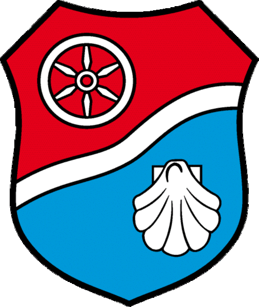
Blazon : "By a silver wave bar diagonally left divided by red and blue, above a six-spoke silver wheel, below a silver Jacobus shell ."
Declaration of coat of arms: The silver wave bar represents the location of Uder on the Leine, the six-spoke silver wheel is the Mainz wheel , which shows that the place belonged to the Electorate of Mainz for centuries . The silver pilgrim shell or scallop shell represents the patronage of the local church of James the Elder , the blue background symbolizes the consecration of Uder and the entire oak field to Mary, the mother of God .
traffic
In terms of traffic, the place is easily accessible via the state road 3080, the federal motorway 38 and a stop on the Halle – Hann railway line. Münden reachable.
Attractions
- Catholic Church of St. James , built in 1910 on the site of two previous buildings from the 12th and 17th centuries. The furnishings include a baroque high altar and a Gothic carved altar.
- Uder is on the Camino de Santiago . Since 1998 a stele has been showing the way to Santiago de Compostela .
- A special kind of attraction is the Lourdes grotto made of natural stone on the Marienhügel, the former cat's head. It was built in 1907 by members of the workers' and gymnastics club. The large statue of the Virgin was obtained directly from Lourdes . It was a gift from some pilgrims to Lourdes. The grotto was inaugurated at the parish fair in 1908. The station path to the grotto was also inaugurated in 1908.
- The Ossenritter monument (creator: the native Uderan Heimo Ertl ) was erected in the Leinepark in 2009. It commemorates the announcement that the then Schulze (mayor) of Uder, Hans Franz Hase, 1153 by King Frederick Barbarossa a chivalrous horse on an ox for failing Knight was beaten. Since then the inhabitants of Uder have been nicknamed "Ossenritter".
- School museum
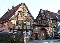
- Knorrsches house and other half-timbered houses in the town center
- Park on a leash
- Evangelical Christ Chapel
- Uder is located on the Leine-Heide cycle path and offers numerous hiking trails in the vicinity, including to the log cabin on the Wessen.
Sons and daughters of the church
- Johannes Weinrich (1793–1855), folk artist, inventor of the harmonica
- Martin Weinrich (1865–1925), dialect poet
- Gerhard Michael Artmann (* 1951), biophysics professor and author
literature
- Bernhard Siebert: Uder and his story. Part 1: A contribution to the political and economic history of the Eichsfeld, in particular of the Rusteberg office. According to archival and other sources. Cordier, Heiligenstadt 1938.
- Bernhard Rinke et al .: Uder and his story. Part 2: Contributions to the development of Uder since 1930. Mecke, Duderstadt 2014
- Council of the community of Uder (ed.): 900 years of Uder 1089-1989 . Mühlhausen 1989, p. 81, format 20 cm × 20 cm .
Web links
Individual evidence
- ^ Population of the municipalities from the Thuringian State Office for Statistics ( help on this ).
- ↑ Michael Köhler: Thuringian castles and fortified prehistoric and early historical living spaces. Jenzig-Verlag 2001, ISBN 3-910141-43-9 , p. 50.
- ^ 2014 municipal council elections in Thuringia - Am Ohmberg
- ↑ http://www.wahlen.thueringen.de/datenbank/wahl1/wahl.asp?wahlart=BM&wJahr=0000&zeigeErg=GEM&auswertung=1&wknr=061&gemnr=61097&terrKrs=&gemteil=000&buchstabe=&Langname=&wahlvorschlag=&sort=&druck=&XLS=&anzahlH = -5 & Non_existing = & x_vollbildDatteil = & optik = & Aktuell = & ShowLand = & ShowWK = & ShowPart = & w_date = 05.06.2016
- ↑ coat of arms | Administrative community Uder. Retrieved March 10, 2019 .


