Kahama (Tanzania)
| Kahama | ||
|---|---|---|
|
|
||
| Coordinates | 3 ° 50 ′ S , 32 ° 35 ′ E | |
| Basic data | ||
| Country | Tanzania | |
| Shinyanga | ||
| ISO 3166-2 | TZ-22 | |
| Residents | 242,208 (2012) | |
Kahama is a city in northwestern Tanzania , in the Shinyanga region .
geography
Kahama has 242,208 inhabitants (as of 2012). The city is located on the western plateau of Tanzania, around one hundred kilometers west of the regional capital Shinyanga at an altitude of 1237 meters. The climate is tropical, Aw according to the effective climate classification . Every year it rains an average of 932 millimeters, in the rainy season from November to April more than 100 millimeters of precipitation fall per month. The months June to September are very dry. The average temperature is 22.8 degrees Celsius, the warmest is October with 24.7 degrees, the coolest in July with 21.3 degrees Celsius.
history
Kahama became a separate town council in 2010. The population rose from 161,745 in 2002 to 242,208 in 2012. This corresponds to an annual growth of over four percent and a doubling every 17 years.
populationThe largest ethnic groups are the Sukuma , Sumbwa and the Nyamwezi . Of those over five, almost sixty percent spoke Swahili , fourteen percent Swahili and English, and around a quarter were illiterate (as of 2012). Facilities and services |
 |
- Education: There are 95 primary schools in Kahama Town, 23 of which are privately owned. 61,157 students are taught in the 72 state schools. Of the 1410 class teachers planned, 1016 are available. 6957 students are enrolled in private schools. Of the 28 secondary schools, 15 are state and 13 private (as of 2017).
- Health: Two hospitals, five health centers and 34 pharmacies are available for the medical care of the population. The most common diseases are acute respiratory failure , pneumonia and malaria (as of 2017).
- Water: In 2017, around two thirds of the population had access to safe and clean water.
Economy and Infrastructure
About half of the working population worked in agriculture, almost a fifth in trade and four percent in mining.
- Agriculture: Rice, corn, sunflowers, manioc , sweet potatoes and beans are grown for personal use, cotton and peanuts are intended for sale. In addition, various types of vegetables are cultivated.
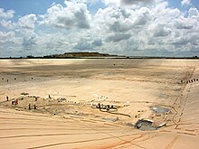
- Mining: Gold is mined in the Buzwagi mine on the southeastern outskirts of Kahama . The company African Barrick Gold bought the mine in 2000 and took it into operation in 2007. In 2011, 2,000 employees extracted 5572 kilograms of gold in Tanzania's largest open-cast mine.
- Railroad: Kahama is forty kilometers from the nearest Isaka station. This is on the TAZARA railway line Tabora - Mwanza .
- Road: The main road connection is the national road T3, which leads to the T8 and Singida in the east and to the border with Rwanda in the west .
religion
Since 1983 Kahama has been a separate Roman Catholic diocese , which belongs to the Archdiocese of Tabora.
Web links
Individual evidence
- ↑ Kahama Town (Tanzania) - Population Statistics, Charts, Map and Location. Retrieved March 20, 2020 .
- ↑ Kahama climate: Average Temperature, weather by month, Kahama weather averages - Climate-Data.org. Retrieved March 20, 2020 .
- ↑ The Kahama Town Strategic Plan 2016 / 17–2020 / 21. (PDF) May 2018, pp. 1–2 , accessed on March 21, 2020 .
- ↑ Maps for thr World, Map 500k - xa36-3. Russian Army Maps, accessed March 20, 2020 (Russian).
- ↑ a b History | Kahama Town Council. Retrieved March 20, 2020 .
- ^ Tanzania Regional Profiles, 17th Shimnyanga Regional Profile. (PDF) The United Republic of Tanzania, p. 15 , accessed on March 20, 2020 .
- ↑ The Kahama Town Strategic Plan 2016 / 17–2020 / 21. (PDF) May 2018, p. 24.30 , accessed on March 21, 2020 .
- ↑ The Kahama Town Strategic Plan 2016 / 17–2020 / 21. (PDF) May 2018, pp. 38, 41 , accessed on March 21, 2020 .
- ↑ The Kahama Town Strategic Plan 2016 / 17–2020 / 21. (PDF) May 2018, p. 51 , accessed on March 21, 2020 .
- ^ Tanzania Regional Profiles, 17th Shimnyanga Regional Profile. (PDF) The United Republic of Tanzania, p. 96 , accessed on March 21, 2020 .
- ↑ The Kahama Town Strategic Plan 2016 / 17–2020 / 21. (PDF) May 2018, p. 5 , accessed on March 21, 2020 .
- ↑ Buzwagi Gold Mine, Shinyanga. Retrieved March 21, 2020 (UK English).
- ↑ Isaka to Kahama. Retrieved March 21, 2020 (de-US).
- ↑ Lonely Planet: Getting around Tanzania by train. Retrieved March 21, 2020 .
- ^ Tanzania Trunk Road Network. Retrieved March 21, 2020 .
- ↑ Kahama (Roman Catholic Diocese). Retrieved March 20, 2020 .


