
Kalowswerder

Kalowswerder (also: Der Kalowswerder) is the historical name of a location in the Berlin district of Charlottenburg .
Location and history
Kalowswerder is bounded in the south and west by the Spree , in the north by the Berlin Ringbahn or the Westhafen Canal and in the east by the Charlottenburg connecting canal . The name goes back to a Casow farm on the site north of the Spree, which was mentioned in the late Middle Ages .
After a few small factories had already settled in Kalowswerder in the middle of the 19th century, the then still independent city of Charlottenburg used the area for its northward expansion in the 1890s. Gustav-Adolf-Platz (today's Mierendorffplatz ) was created as the center of the new district . The representative building of the Royal District Court III Berlin was built on Tegeler Weg . With the gasworks on Gaußstrasse and the Charlottenburg power plant on the banks of the Spree, Kalowswerder became the central location for Charlottenburg's energy supply. In terms of traffic, Kalowswerder was opened up by the Jungfernheide station of the Berlin Ringbahn, which opened in 1894 . The Österreichpark (previously: Sömmeringanlage) was opened on the northern bank of the Spree at the Caprivibrücke in 2013 .
The term Kalowswerder is rarely used in common language today. More common is the reference to the centrally located Mierendorffplatz , so that mostly the Mierendorffkiez , and occasionally the Mierendorff Island, is mentioned. Kalowswerder is part of the Berlin-Spandau - Charlottenburg North constituency .
- Impressions from Kalowswerder

The castle hill connects Kalowswerder with the old town of Charlottenburg
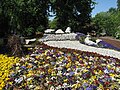
Alpine rock garden in the Österreichpark

District Court on Tegeler Weg


Web links
- Walk through Kalowswerder around Mierendorffplatz. District Office Charlottenburg-Wilmersdorf of Berlin, 2004, accessed on June 11, 2008 .
Individual evidence
- ↑ Press release of the district office on the Kiezfest 2011. Accessed on December 29, 2011
Coordinates: 52 ° 32 ' N , 13 ° 18' E