Kalurong
| Kalurong | ||
|---|---|---|
|
Summit of Kalurong, view from the north |
||
| height | 6674 m | |
| location | Tibet ( PR China ) | |
| Mountains | Lhagoi Kangri | |
| Dominance | 11.14 km → Noijinkangsang | |
| Notch height | 1457 m ↓ (5217 m) | |
| Coordinates | 28 ° 51 '2 " N , 90 ° 12' 24" O | |
|
|
||
| First ascent | September 28, 2005 by a japan. expedition | |
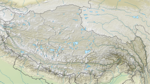
The Kalurong (also Kaluxung ) is a mountain in the autonomous region of Tibet .
The 6674 m high Kalurong is located in Nagarzê County . The Kalurong massif is located in the Lhagoi Kangri belt between the main Himalayan chain in the south and the Yarlung Zangpo river (Brahmaputra upper reaches) in the north, which separates the Himalayas from the Transhimalayas . From the 7206 m high and 11.14 km further north Noijin Kangsang the massif Kalurong by a valley, in which is provincial road 307 extends separately.
The Kalurong still has a south summit 1.74 km southeast (6536 m, ⊙ ).
Ascent history
A Japanese expedition consisting of seven mountaineering veterans from the Keiō University Alpine Club with an average age of 66 years managed to climb the mountain for the first time in September 2005 . Eiichiro Kasai (64) and Tadao Shintan (61) reached the summit on September 28, 2005.
Web links
- Kalurong, China on Peakbagger.com (English)
- Kalurong at summitpost.org

