Transhimalaya
| Transhimalaya (Gangdisê-Nyainqêntanglha Mountains, Heding Mountains) |
||
|---|---|---|
|
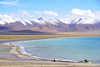
Part of the Nyainqêntanglha chain in the Transhimalaya |
||
| Highest peak | Nyainqêntanglha ( 7162 m ) | |
| location | Tibet ( PR China ) | |
| part of | Alpine mountain belt , highlands of Tibet (foothills) | |
|
|
||
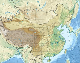
| Coordinates | 30 ° N , 91 ° E | |
The Transhimalaya , also Gangdisê - Nyainqêntanglha Mountains ( 冈底斯 - 念青唐古拉 山脉 , Gāngdǐsī-Niànqīngtánggǔlā Shānmài ), outdated Hedingebirge , is a mountain range in southern Tibet that extends largely parallel to the Himalayas in an east-west direction. Sometimes it is understood as part of the extended Himalayan mountain system.
For naming
The term Transhimalaya shows the western perspective of the view from India, since the mountains extend "beyond" (trans-) the Himalayas. In the region itself, the name "Transhimalaya" is largely unknown, the western part of the mountains is referred to as Gangdisê and the eastern part as Nyainqêntanglha . The name Hedingebirge was given in the late 19th century after its researcher Sven Hedin .
geography
The Transhimalaya extends over 1,600 km in length, with a north-south width of 80 km, and forms a mountain range of the Tibetan plateau , and thus the watershed between the inland rivers and the rivers that flow into the sea, as well as the border line between north and south Tibet . It is separated from the Himalayas in the south by the great river valleys Indus / Satluj and Yarlung Tsangpo ( Brahmaputra upper reaches) .
The mountain range reaches an average height of about 5800- 6000 m , with slopes on the eastern and western end. Only a few peaks protrude above this height zone and reach heights of 6500 m , occasionally over 7000 m . To the south the mountains drop abruptly into the valleys, which run at an altitude of 3000 to 4300 m , and reach flanks of around 2000 m . To the north it goes relatively flat into the steppe-like and often desert-like landscape of the central Tibetan highlands ( Changthang ) with an average height of about 5000 m , so that the mountains there are only about 1000 m above the relief.
The permanent snow line is around 6000 m . The climate is characterized by very cold winters and relatively warm summers. Since the mountains lie in the monsoon shadow of the Himalayas, the amount of precipitation is very low at around 400 mm per year.
The largest city in the Transhimalaya is Lhasa . The Tibetan capital lies in a high mountain valley in the east of the mountain range.
structure
The western, lower part of the mountain range is called Gangdisê . The best-known and most distinctive peak of this mountain range is Mount Kailash (Kangrinboqê) at 6714 m, which is holy for several religions .
The Nyainqêntanglha forms the eastern part of the Transhimalaya, which reaches its highest point in the mountain of the same name Nyainqêntanglha ( 7162 m ) between Lhasa and the lake Nam Co (Tengrinor).
Individual evidence
- ^ Hubert and Berit Kaier: Tibet. Geography. In: dokhyi-tibet-hunde.de. Retrieved February 17, 2009 (further information on geography, climate, fauna and flora).


