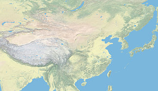
Nyainqêntanglha (mountains)
| Nyainqêntanglha | ||
|---|---|---|
| Highest peak | Nyainqêntanglha ( 7162 m ) | |
| location | Tibet ( PR China ) | |
| part of |
Transhimalaya (Gangdisê-Nyainqêntanglha mountain range) |
|
|
|
||
| Coordinates | 30 ° N , 91 ° E | |
| Tibetan name |
|---|
|
Tibetan script :
གཉན་ ཆེན་ ཐང་ ལྷ་
|
|
Wylie transliteration : gnyan chen thang lha
|
|
Official transcription of the PRCh : Nyainqêntanglha
|
|
THDL transcription : Nyenchenthanglha
|
|
Other spellings: Nyentschentangla, Nyenchen Thangla, Nyenchen Tangla
|
| Chinese name |
|
Traditional :
念青唐古拉 山
|
|
Simplified :
念青唐古拉 山
|
|
Pinyin : Niànqīngtánggǔlā Shān
|
The Nyainqêntanglha (also Nyenchen Tanglha also Nyenchen Thanglha or Nyenchen Tangla ) is an approximately 750 km long mountain range in the Tibet Autonomous Region of the People's Republic of China .
Together with the Gangdisê Mountains to the west, it forms the Transhimalaya . The mountains, the watershed between the Yarlung Zangbo ( Brahmaputra -Oberlauf) and the Nu Jiang (Salween). In the north of the mountains extend the alpine steppes of the Chang Tang , there is also the largest Tibetan lake Nam Co .
The mountains are divided into a western and an eastern part, the border of which is at the 5432 m high Tro La pass above the lake Arza Co (Tib. Ar rtsa mtsho , ཨར་ རྩ་ མཚོ ་ , Chin. Āzhā Cuò 阿扎 错 ), too Artsa Tso , or Atsa Tso , is marked. Of the located in the western part four seven-meter peaks is with 7162 m highest peak of Nyainqentanglha , located in the district of Damxung , north of the Tibetan capital Lhasa and south of the Nam Co located. The next place is Yangbajain .
The heavily glaciated eastern part is characterized by over 240, so far largely unclimbed six-thousanders. The highest peak is the 6,956 m high Sepu Kangri (Chin. Sèpǔ Gāngrì 色 普冈 日 ). The longest glacier is the 35 km long Kyagqen Glacier (glacier front 94 ° 50 ' E , 30 ° 23' N). According to the Introduction to the Glaciers of China by the Lanzhou Glaciers Research Institute, published in Chinese in 1988 , the Nyainqêntanglha mountain range contains a total of 2905 glaciers with a total area of 5898 km².
literature
- Tamotsu Nakamura: The Alps of Tibet. Detjen-Verlag, Hamburg 2008, ISBN 978-3-937597-25-6
Web links
- Qinghai-Tibet railway lays track to Nyainqentanglha Mountain . In: China Tibet Information Center , June 5, 2005
Individual evidence
- ↑ 国家 测绘 局 地名 研究所 (Ed.): ༄ ༅ ༎ བོད་ ལྗོངས་ ས་ མིང ༎ / «西藏 地名» . Beijing: ཀྲུང་ གོའ ི་ བོད་ རིག་པ་ དཔེ་ སྐྲུན་ ཁང ། / 中国 藏 学 出版社 , 1995, ISBN 7-80057-284-6 , p. 347.
- ^ Charles Clarke: Through the Eastern Nyenchen Tanglha. The Alpine Journal, 1999, Vol. 104, pp. 29-33
- ^ Tibet map 1: 1,500,000, 2nd edition, Reise Know-How Verlag, Bielefeld
- ^ Tibet map, scale 1: 1,500,000, Reise Know-How Verlag
- ↑ 国家 测绘 局 地名 研究所 (Ed.): ༄ ༅ ༎ བོད་ ལྗོངས་ ས་ མིང ༎ / «西藏 地名» . Beijing: ཀྲུང་ གོའ ི་ བོད་ རིག་པ་ དཔེ་ སྐྲུན་ ཁང ། / 中国 藏 学 出版社 , 1995, ISBN 7-80057-284-6 , p. 6.
- ^ Gyurme Dorje, Tibet, Footprint
- ↑ Tamotsu Nakamura: The Alps of Tibet - A Journey though the Nyenchentangla East . In: The Alpine Journal , 2002
- ↑ Nyenchen Thanglha. "Grosser Nyen, god of the heavenly plains". (No longer available online.) Emmet.de, April 2008, archived from the original on April 9, 2014 ; Retrieved February 17, 2009 . Info: The archive link was inserted automatically and has not yet been checked. Please check the original and archive link according to the instructions and then remove this notice.
- ↑ Concern Atlas . 101st edition. Ed.Hölzel, Vienna 1975, India / Southeast Asia, p. 110/111 (there Nyentschentangla ).
- ↑ No. 223. In: Hartmut Bielefeldt: The highest mountains in the world. In: Hartmut's Homepage - Mountains. September 1, 2008, accessed February 17, 2009 .
- ↑ Tamotsu Nakamura: The Alps of Tibet . Detjen-Verlag, Hamburg 2008, pp. 20-22
- ↑ Tamotsu Nakamura: The Alps of Tibet . Detjen-Verlag, Hamburg 2008, p. 21
