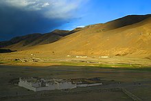
Damxung
| Tibetan name |
|---|
|
Tibetan script :
འདམ་ གཞུང་ རྫོང །
|
|
Wylie transliteration : 'dam gzhung rdzong
|
|
Official transcription of the PRCh : Damxung
|
|
THDL transcription : Damzhung
|
|
Other spellings: Damshung
|
| Chinese name |
|
Traditional :
當雄縣
|
|
Simplified :
当雄县
|
|
Pinyin : Dāngxióng Xiàn
|
Damxung (also: Damshung) is a district of the prefecture -level city of Lhasa in the Tibet Autonomous Region of the People's Republic of China . In 1999 it had 38,473 inhabitants. The seat of the people's government of Damxung is Damchukha. The district is on the Qinghai-Tibet Road and Railway . The annual average temperature is 1.3 ° C, the average temperature in January −10.2 ° C, in July 10.7 ° C.
Administrative division
| Surname | Tibetan | Wylie | Chinese | Pinyin |
|---|---|---|---|---|
| Damquka | འདམ་ ཆུ་ ཁ ། | 'dam chu kha | 当 曲 卡 镇 | Dāngqǔkǎ Zhèn |
| Yangbajain | ཡངས་ པ་ ཅན །། | yangs pa can | 羊八井 镇 | Yángbājǐng Zhèn |
| Gyaidar | རྒྱས་ དར །། | rgyas dar | 格达 乡 | Gédá Xiāng |
| Nyingzhung | སྙིང་ དྲུང ། | snying drung | 宁 中 乡 | Níngzhōng Xiāng |
| Gongtang | ཀོང་ ཐང ། | kong thang | 公 塘乡 | Gōngtáng Xiāng |
| Lung ring | ལུང་ རིང ། | lung ring | 龙 仁 乡 | Lóngrén Xiāng |
| Wumatang | དབུ་ མ་ ཐང ། | dbu ma thang | 乌玛 塘乡 | Wūmǎtáng Xiāng |
| Namco | གནམ་ མཚོ ། | gnam mtsho | 纳木错 乡 | Nàmùcuò Xiāng |
Web links
- dangxiong.gov.cn
- Official website ( Memento of November 22, 2007 in the Internet Archive )
Individual evidence
- ↑ China County & City Population 1999 FAQ China Historical GIS, Faculty of Arts and Sciences, Harvard University.
- ↑ 当雄县 行政 区划 网 .
- ↑ Guójiā cèhuìjú dìmíng yánjiūsuǒ 国家 测绘 局 地名 研究所 : Xīzàng dìmíng «西藏 地名» / bod ljongs sa ming ༄ ༅ བོད་ ལྗོངས་ ས་ མིང ༎ . Zhōngguó Zàngxué chūbǎnshè 中国 藏 学 出版社 , Beijing 1995, p. 109.
Coordinates: 30 ° 31 ' N , 90 ° 46' E

