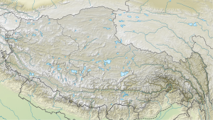
Nam Co
|
Nam Co Namtso, Namu Cuo, Tengri-Nor |
||
|---|---|---|

|
||
| Holy stone at Nam Co, against the Nyainqêntanglha chain in the south | ||
| Geographical location | Circles Baingoin , Damxung in the administrative district of Nagqu in Tibet (China) | |
| Drain | none ( endorheic ) | |
| Data | ||
| Coordinates | 30 ° 42 ′ N , 90 ° 33 ′ E | |
|
|
||
| Altitude above sea level | 4718 m above sea level M. | |
| surface | 1 967 km² | |
| length | 70 km | |
| width | 30 km | |
| Maximum depth | 125 m | |
| Catchment area | 10,741 km² | |
|
particularities |
endorheic salt lake |
|
| Tibetan name |
|---|
|
Tibetan script :
གནམ་ མཚོ་
|
|
Wylie transliteration : gnam mtsho
|
|
Official transcription of the PRCh : Nam Co
|
|
THDL transcription : Namtsho
|
|
Other spellings: Namtso, Namco
|
| Chinese name |
|
Traditional :
納木錯
|
|
Simplified :
纳木错
|
|
Pinyin : Nàmù Cuò
|
The Nam Co (also Namtsho or Namtso ; Tibetan གནམ་ མཚོ་ Wylie gnam mtsho , Chinese 納木錯 / 纳木错 , Pinyin Nàmù Cuò ; Mongolian Tengrinor "sky lake ") is a salt lake in the Tibet Autonomous Region of the People's Republic of China .
It is located at the northern foot of the Nyainqêntanglha Mountains at an altitude of 4718 m on the border between the Damxung ( 'dam gzhung ; Chinese 当 雄 , Pinyin Dāngxióng ) and Baingoin ( dpal mgon ; Chinese 班 戈 , Pinyin Bāngē ) and has an area of over 1967 square kilometers after the Qinghai Lake (Kokonor) the second largest salt lake in China. Its extension from east to west is over 70 kilometers, from north to south over 30 kilometers. According to recent studies, its maximum depth is 125 m and about 50% of the lake is more than 90 m deep. Tashi Dor forms a peninsula of the lake .
climate
The weather at Nam Co is changeable and characterized by severe weather changes. About 90% of precipitation falls in summer, usually as snow or hail. Violent thunderstorms with heavy snowfall can occur even in August. Temperatures fluctuate between -16 ° C in winter, with temperatures dropping as low as -40 ° C, and around 9 ° C in summer, but temperatures below 0 ° C are also possible in July and August, albeit rarely. Due to the altitude and the resulting cold climate, the lake freezes over completely in December, the up to 30 cm thick layer of ice remains until the end of March. Ice floes can still drift on the lake well into July, but it is ice-free in summer.
In the late Pleistocene , the Nam Co and the Serling Tsho formed a lake with an area of 28,900 square kilometers.
photos
Web links
Individual evidence
- ↑ a b V. H. Phan, RC Lindenbergh, M. Menenti: Geometric Dependency of Tibetan lakes on glacial runoff (PDF; 2.2 MB) Hydrol. Earth Syst. Sci. 17, 4061-4077, 2013.
- ↑ B. Schütt, J. Berking, C. Yi: Holocene Lake Lake Level Changes of Nam Co as a Reaction to Late Glacial Glacier Decay and Holocene Climate Change . (PDF; 6.1 MB) INQUA workshop on Timing and nature of mountain glaciation, from High Asia to the World September 14-22, 2006 Xining, China, p. 33 (book of abstracts)
- ↑ According to another source: 2461 square kilometers - Nam Co ( Memento of the original from February 10, 2006 in the Internet Archive ) Info: The archive link was inserted automatically and has not yet been checked. Please check the original and archive link according to the instructions and then remove this notice. (Columbia Encyclopedia) or 2207 square kilometers - Meyer's large pocket dictionary in 24 volumes . BI-Taschenbuchverlag 1992
- ↑ Chinese, German scientists record new depth of Nam Co Lake ( Memento of the original from December 3, 2010 in the Internet Archive ) Info: The archive link was automatically inserted and not yet checked. Please check the original and archive link according to the instructions and then remove this notice.
- ↑ Zheng Mianping: An Introduction to Saline Lakes on the Qinghai-Tibet Plateau. Kluwer, Dordrecht 1997, ISBN 0-7923-4098-1 , p. 50f.


