Serling Tsho
|
Serling Tsho Sêrling Co |
||
|---|---|---|

|
||
| Satellite photo of the Serling Tsho | ||
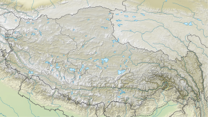
| Geographical location | Circles Baingoin , Xainza the administrative district of Nagqu in Tibet ( China ) | |
| Tributaries | Za'gya Tsangpo, Boqu Tsangpo | |
| Data | ||
| Coordinates | 31 ° 50 ′ N , 89 ° 0 ′ E | |
|
|
||
| Altitude above sea level | 4530 m | |
| surface | 1 640 km² | |
| length | 72 km | |
| width | 22.8 km | |
| Maximum depth | 33 m | |
|
particularities |
outflowless salt lake |
|
| Tibetan name |
|---|
|
Tibetan script :
སེར་ གླིང་ མཚོ
|
|
Wylie transliteration : ser gling mtsho
|
|
Official transcription of the PRCh : Sêrling Co
|
|
THDL transcription : Serlingtso
|
|
Other spellings: Siling Co, Silingtso, Selling-tso
|
| Chinese name |
|
Traditional :
色 林 錯
|
|
Simplified :
色 林 错
|
|
Pinyin : Sèlín Cuò
|
The Serling Tsho ( Tib .: ser gling mtsho, Tibetan : སེར་ གླིང་ མཚོ , Sêrling Co ) is the second largest lake in the Tibet Autonomous Region in the People's Republic of China .
location
The Serling Tsho lies at 4530 meters above sea level, north of the Gang Tise Mountains, on the border of the Pelgön ( 班 戈 县 / དཔལ་ མགོན་ རྫོང་ ) and Shentsa ( 申 扎 县 / ཤན་ རྩ་ རྫོང་ ) districts in the administrative district Nagchu , stretching 72 kilometers from west to east, 22.8 kilometers from north to south, has an area of 1,640 square kilometers and is up to 33 meters deep. The Serling Tsho is a salt lake . It is fed by the Za'gya Tsangpo ( 扎加 藏 布 ) and the Boqu Tsangpo ( 波 曲 藏 布 ) rivers.
history
In the early and middle Pleistocene , the Serling Tsho, together with today's Namtsho and other lakes, formed a common water surface of 29,800 square kilometers. In the late Pleistocene 30,000 years ago the water surface decreased, so that today's Dung Tsho and Nag Tsho emerged. The Bangkog Tsho was separated from the Serling Tsho 16,000 years ago . 5200 to 3600 years ago the water surface of the Bangkog Tsho was divided into three smaller lakes.
climate
The annual average temperature at the lake is −3 to −0.6 ° C, the annual maximum temperature 9.4 ° C, the lowest monthly mean in January −16 ° C, although temperatures can drop to −40 ° C. The lake therefore freezes over completely in winter. Ice floes can drift on the lake until the end of May, but the lake is ice-free in the summer months. The precipitation averages 290 millimeters per year, 90 percent of which falls in the months of June to September, often as hail in summer .
use
The Serling Tsho is located in a national nature reserve . There is only one species of fish in the lake, Gymnocypris selincuoensis ; it is used by fishermen. The steppe on the shores of the lake traditionally serves as pasture for yaks and sheep .
literature
- Guojia cèhuìjú diming yánjiūsuǒ 国家测绘局地名研究所 : Xizang diming 西藏地名 / bod ljongs sa ming བོད་ ལྗོངས་ ས་ མིང་ (Beijing, Zhōngguó Zàngxué chūbǎnshè 中国藏学出版社 1995), ISBN 7-80057-284-6 , P. 445.
- Chén Yìfēng 陈毅峰 , Hé Dékuí 何德奎 , Duàn Zhōnghuá 段 中华 : Sèlíncuòluǒlǐ de niánlún tèzhēng 色 林 错 裸 鲤 的 年轮 特征 . In: Dòngwùxué bào 动物 学报 / Acta Zoologica Sinica , 48.3: 384–392 (June 2002).
- Zheng Mianping: An Introduction to Saline Lakes on the Qinghai-Tibet Plateau (Dordrecht / Boston / London, Kluwer 1997), ISBN 0-7923-4098-1 .
Web links
- Sèlín Cuò 色 林 错 (China Tibet Information Center; in Chinese)
