Noijinkangsang
| Noijinkangsang | ||
|---|---|---|
|
View from Kamba La to the Yamdrok Yumtso and the Noijinkangsang |
||
| height | 7206 m | |
| location | Tibet Autonomous Region ( PR China ) | |
| Mountains | Lhagoi Kangri ( Himalaya ) | |
| Coordinates | 28 ° 56 '54 " N , 90 ° 10' 42" O | |
|
|
||
| First ascent | April 28, 1986 by a Chinese expedition | |
| Tibetan name |
|---|
|
Tibetan script :
གནོད་ སྦྱིན་ གང་ བཟང་
|
|
Wylie transliteration : gnod sbyin gang bzang
|
|
Pronunciation in IPA : [
nøtɕĩkʰaŋsaŋ ]
|
|
Official transcription of the PRCh : Noijinkangsang
|
|
THDL transcription : Nöjinkangsang
|
|
Other spellings: Norin Kang, Ningchin Kangsha
|
| Chinese name |
|
Traditional :
寧 金 崗 桑
|
|
Simplified :
宁 金 岗 桑
|
|
Pinyin : Níngjīngǎngsāng
|
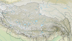
The Noijinkangsang (also Norin Kang or Ningchin Kangsha ) is a 7206 m high mountain in the People's Republic of China .
It lies on the border between Nagarzê and Gyangzê counties in the Tibet Autonomous Region and is part of the Himalayas . It belongs to the Lhagoi Kangri belt between the main chain of the Himalayas in the south and the river Yarlung Zangpo ( Brahmaputra upper reaches) in the north, which separates the Himalayas from the Transhimalayas . The altitude data vary between 7191 m and 7252 m . It was first climbed on April 28, 1986 by a Chinese expedition from the south. Today, commercial providers mostly use a route over the southwest ridge and Togolung or from the small glacial lake Gama Tso over the east ridge.
In addition to the main peak, the Noijinkangsang massif has numerous secondary peaks:
- Togolung ( 6733 m )
- Dara ( 6222 m )
- Lungba ( 6151 m )
- Qunyang ( 6121 m )
- Zhokpu ( 5922 m )
The massif is heavily glaciated, some of these glaciers (listing north to south) reach down to an altitude of 5200 m :
- Lungba Glacier
- Qunyang glacier
- Dara glacier
- Gama glacier
- Noijin Glacier
- Togolung glacier
- Kangbu glacier
- Kara or Karo Glacier
The Noijinkangsang is the larger main peak of the Himalayas closest to Lhasa, north of the Yarlung Zangpo . South of the massif, the provincial road 307 crosses the Karo La pass , which separates the Noijinkangsang from the Jitan Zhoma ( 6004 m ) and the Kalurong massif ( 6674 m ).
Web links
- Norin Kang, China on Peakbagger.com (English)
- List of all mountains higher than 6,759 meters and additional information, www.8000ers.com , accessed December 7, 2009
- The Noijin Kang at www.summitpost.org , accessed December 7, 2009
Footnotes
- ↑ 国家 测绘 局 地名 研究所 (Ed.): ༄ ༅ ༎ བོད་ ལྗོངས་ ས་ མིང ༎ / 《西藏 地名》 . Beijing: ཀྲུང་ གོའ ི་ བོད་ རིག་པ་ དཔེ་ སྐྲུན་ ཁང ། / 中国 藏 学 出版社 , 1995, ISBN 7-80057-284-6 , p. 353.


