Karamana
| Karamana | ||
| Data | ||
| location | Kerala ( India ) | |
| River system | Karamana | |
| source | in the Western Ghats, 8 ° 39 ′ 50 " N , 77 ° 11 ′ 40" E |
|
| Source height | approx. 1500 m | |
| muzzle |
Arabian Sea Coordinates: 8 ° 25 ′ 29 " N , 76 ° 57 ′ 26" E 8 ° 25 ′ 29 " N , 76 ° 57 ′ 26" E |
|
| Mouth height | 0 m | |
| Height difference | approx. 1500 m | |
| Bottom slope | approx. 22 ‰ | |
| length | 68 km | |
| Reservoirs flowed through | Peppara Dam , Aruvikkara Dam | |
| Navigable | No | |
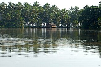
The Karamana is a coastal river in the southern Indian state of Kerala .
course
The Karamana flows through Thiruvananthapuram , the capital of the state. The source of the approximately 68 km long river is located on the southernmost foothills of the Western Ghats near the 1868 m high Agastya Malai near the small town of Panavoor . The westward flowing river flows into the Arabian Sea in the Poonthura catchment area . The river is named for Karamana, a suburb of Thiruvananthapuram through which it flows.
Tributaries and reservoirs
The relatively short Karamana has only a few smaller tributaries; the most important is the Killiyar , which joins the Karamana at Pallathukadavu . The course of the river is interrupted by two dams, namely the Peppara Dam , which mainly accumulates water for irrigation, and the Aruvikkara Dam , which also serves as a drinking water reservoir for Thiruvananthapuram.
bridges
The largest bridge spans the river at Karamana. Other important bridges are at Thrikkunnapuram, Mangattu Kadavu, Kundamon Kadavu, Vellaikadavu, Aruvikkara (dam), Maruthoor kadavu and Aryanad near Malamukal.
