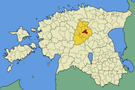
Kareda
| Kareda | |||
|
|||
| State : |
|
||
| Circle : |
|
||
| Coordinates : | 58 ° 31 ' N , 22 ° 54' E | ||
| Area : | 91 km² | ||
| Residents : | 803 (2010) | ||
| Population density : | 9 inhabitants per km² | ||
| Time zone : | EET (UTC + 2) | ||
| Website : | |||

|
|||
Kareda was a rural municipality in the Estonian district of Järva with an area of 91.6 km². It has 803 inhabitants (as of 2010).
In addition to the main town Kareda (69 inhabitants), the municipality included the villages Esna, Müüsleri , Köisi, Öötla and Vodja.
Karede was first mentioned in 1212 in the Liber Census Daniae . The Esna manor is particularly worth seeing. The main house was built in 1821, the side wings in 1880. The park is in the English style .
Web links
- Kareda Municipality website (Estonian)


