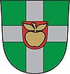
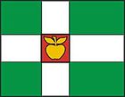
Türi
| Türi | |||
|
|||
| State : |
|
||
| Circle : |
|
||
| Coordinates : | 58 ° 48 ' N , 25 ° 26' E | ||
| Area : | 599 km² | ||
| Residents : | 11,098 (2010) | ||
| Population density : | 19 inhabitants per km² | ||
| Time zone : | EET (UTC + 2) | ||
| Website : | |||

|
|||
Türi is a rural municipality in the Estonian district of Järva (Jerwen) with an area of 599 km². It has 11098 inhabitants (as of January 1, 2010).
structure
In addition to the town of Türi (German: Turgel ), the municipality includes the villages of Äiamaa, Änari, Arkma, Jändja, Kabala, Kahala, Karjaküla, Kirna , Kolu, Kurla, Kärevere , Laupa, Lokuta, Meossaare, Metsaküla, Mäeküla, Näsuvere, Oisu , Ollepa, Pala, Pibari, Poaka, Põikva, Rassi, Raukla, Retla, Rikassaare, Saareotsa, Särevere, Sagevere, Taikse, Tori, Tännassilma, Türi-Alliku, Vilita, Villevere and Väljaotsa.
Culture and sights
The Laupa manor house is particularly worth seeing. It was built in 1914 on the site of the previous building that burned down in 1905 in the pseudo-baroque style with numerous Renaissance elements for Otto Freiherr von Taube . The 4 hectare park surrounding the manor is located on the banks of the Pärnu River .
The Kirna mansion was built in the classical style for the von Fersen family .
Personalities
- Voldemar Rõks (1900–1941), Estonian national football player
- Aleksander Saharov (* 1982), football player
Web links
- Türi Municipality website (Estonian)


