Kazakh threshold
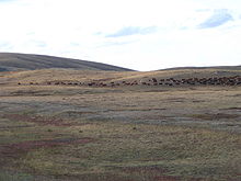
The Kazakh threshold ( Kazakh Қазақтың ұсақ шоқысы , also Сарыарқа (Saryarka)) is a hilly mountain range towering up to 1565 m in the eastern half of Kazakhstan ( Central Asia ).
The threshold , which in some cases towers like a low mountain range, extends east-west between the town of Semei on the Irtysh and the Ulutau Mountains near Sheqasghan, which is sometimes assigned to the Kazakh threshold .
In its central part, southeast of Karagandy (Karaganda), rises the Karkaraly mountain range with the highest mountain Aksoran . The north of the Kazakh threshold, which has numerous mineral resources, is structured steppe -like, the south semi-desert .
The Kazakh threshold is surrounded by the Kulunda steppe in the northeast, Lake Balkhash in the southeast, the Hunger Steppe (Betpak-Dala) in the south, the Ulutau in the west and the plain on Lake Tengiz in the northwest.
Since 7 July 2008, with Saryarka to an area of the Kazakh Uplands World Heritage of UNESCO declared.
Coordinates: 48 ° 25 ′ 37 " N , 75 ° 28 ′ 47" E
