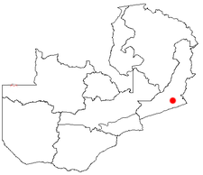
Katete
Katete is a place with 12,500 inhabitants (2006 estimate) on the Great East Road in the Eastern Province in Zambia . It is 1276 meters above sea level and is the seat of the administration of the district of the same name with 3989 km² and 223,947 people (2005).
economy
Like the neighboring Chadiza district, Katete is a cotton-growing area. Both had a cotton tax revenue of $ 600,000 in 2005. Furthermore, it is agrarian with livestock farming. Cattle, goats, pigs and chickens are kept. The soils are poor in nitrogen, depleted by growing maize without fertilization. Planting trees to improve the soil became one of the goals in this region from 1994 and shows good results, so that “agroforestry” is meanwhile a sure-fire success among farmers. In the meantime, two harvests a year can be achieved with irrigation, as a deep well has been drilled.
Katete District is better known for malnutrition, which affects half the population. Cotton farmers who cultivate on a contractual basis achieved an annual income of 1,000 euros in 2005. The main problems are low rainfall and erosion due to logging for land reclamation and charcoal production. In addition, unlike Petauke , the soils are sandy and can therefore hardly store water. The road network in the district is considered sufficient, but insufficiently maintained. Many connections are impassable in the rainy season.
Aquamarines are found in the area between Katete and Petauke , fetching $ 800 per carat.
health
The St. Francis Hospital just before the town of Katete with 350 beds is the most important facility and the largest of its kind in Zambia. It is run by church organizations and offers free services in this densely populated area, where 50% of the residents are under 15 years of age. 20% of the population are infected with HIV , life expectancy is 33 years, child mortality is 180 per 1,000 births (national average: 87 out of 1,000). This hospital has become a center of treatment in Zambia - with a corresponding presence in medical and development magazines.
Utilities
There are shops, a supermarket, a cotton mill, primary and secondary schools (the Humboldt-Gymnasium in Berlin-Tegel has been collecting money for buildings, benches and boards since 2004).
traffic
The place is on the T4 trunk road . There is an unpaved, 1000 meter long runway here.
See also
- For a map with all districts and provinces see: Administrative division of Zambia
Web links
Coordinates: 14 ° 3 ′ S , 32 ° 3 ′ E
