Katzenbergpass
| Katzenbergpass | |||
|---|---|---|---|
|
Katzenbergpass |
|||
| Pass height | 480 m above sea level NHN | ||
| state | Bavaria , Germany | ||
| Valley locations | Schönaich | Ebersbrunn | |
| Lock | No | ||
| Mountains | Steigerwald | ||
| Map (Bavaria) | |||
|
|
|||
| Coordinates | 49 ° 49 '13 " N , 10 ° 26' 42" E | ||
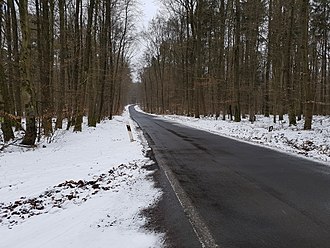
The Katzenbergpass is a 480 m high mountain pass in Germany , which is located in the northern part of Bavaria in the Steigerwald .
Geographical location
The road SW 50 and KT 47 leading over the Katzenberg connects the two villages of Schönaich (Oberschwarzach) and Ebersbrunn . The Katzenbergpass is the second highest pass in the Steigerwald after the Zabelsteinpass . To the west of the pass is the Kreuzberg.
Katzenberg
The Katzenberg belongs with 480 m above sea level. NHN to the highest mountains in the Steigerwald and in the district of Schweinfurt . It is located in the south-eastern part of the Schweinfurt district in Lower Franconia , right on the border with the Kitzingen district .
The source of the Reichen Ebrach is located on the southern slopes at approx. 460 m . The mountain is heavily forested, especially on the western slopes.
Web links
Individual evidence
- ^ Katzenberg (480 m). Retrieved February 15, 2018 .
- ↑ passports lexicon Steigerwald (Germany) for racing cyclists. Retrieved February 15, 2018 .

