Katzenstein (Pobershau)
| Katzenstein | ||
|---|---|---|
| height | 706 m | |
| location | Saxony ( Germany ) | |
| Mountains | Ore Mountains | |
| Coordinates | 50 ° 37'56 " N , 13 ° 14'15" E | |
|
|
||
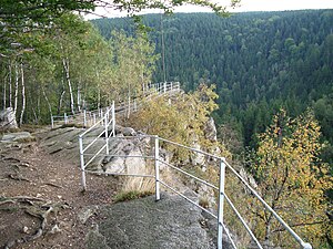
A rock formation east-southeast of Pobershau in the Ore Mountains is called Katzenstein . The highest point is about 706 m above sea level. NN and about 90 m above the valley floor of the Schwarzen Pockau , to which it falls steeply.
history
The Katzenstein got its name because of a ledge that resembled the shape of a cat's head. When the rock threatened to fall, it was removed for safety reasons.
view
The plateau offers a wide view to the east and the Schwarzwassertal at your feet. To the east you can see the elongated rock formation "Ringmauer", which runs in an arch. In the southeast the Rabenberg rises with the steep mountain top of the Liebenstein surrounded by the river. At this point, the scale in the 12th century fortification was Raubschloss Liebenstein , the ruined tower to have been to the 18th century visible.

