Ked Ra Ngchemiangel
| Ked Ra Ngchemiangel | ||
|---|---|---|
| National Register of Historic Places | ||
|
|
||
| location | Aimeliik , Palau | |
| Coordinates | 7 ° 26 '38 " N , 134 ° 29' 19.7" E | |
| surface | 6.1 ha | |
| Architectural style | Ground monument | |
| NRHP number | 76002196 | |
| The NRHP added | September 30, 1976 | |
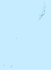
Ked Ra Ngchemiangel (also: Kamyangel Terraces ) are a number of man-made terraces and walls in Aimeliik , a state on the island of Babeldaob in the island state of Palau . They were 1976 in the National Register of Historic Places of the United States recorded when Palau still part of the United States Pacific Trust Territories was.
geography
The terraces are located near the confluence of the Kamyangel (river) in Ngchemiangel Bay at Ngedebech . The area covers 6.1 hectares (15 acres ). The terraced hills are clearly of human origin from prehistoric times. Its origin and purpose are unknown. The hills are arranged in an arch with a view of the bay. From the air you can see that these terraces partly have a stepped structure as "crown and brim" (crown and brim ), similar to a wide-brimmed hat. The highest of the hills reaches 58 m (190 ft).
See also
Individual evidence
- ↑ a b National Register Information System . In: National Register of Historic Places . National Park Service . Retrieved July 9, 2010.
- ↑ geonames.org .
- ↑ Historic and Prehistoric sites, Preservation of Culture and Cultural Tourism in the Trust Territory of the Pacific Islands (PDF pages 26-27) . 1977. Retrieved August 27, 2019.
literature
- Republic of Palau Adventure and Dive Guide. Guide to the undisputed Best Diving in the World. Franko Maps Ltd. 2016.

