Kerinci (mountain)
| Kerinci | ||
|---|---|---|
|
Kerinci viewed from Kayuaro |
||
| height | 3805 m | |
| location | Sumatra , Indonesia | |
| Mountains | Barisan Mountains | |
| Dominance | 1905 km → Kinabalu | |
| Notch height | 3805 m | |
| Coordinates | 1 ° 41 '49 " S , 101 ° 15' 52" E | |
|
|
||
| Type | Stratovolcano | |
| Last eruption | 2016 | |
| particularities | Highest mountain in the Asian part of Indonesia and highest volcano in Indonesia | |
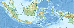
Kerinci , ( Indonesian Gunung Kerinci also Kerinchi outdated, Kerintji ) is an active layer volcano in Indonesia and 3805 m , the highest point on Sumatra . It is located in the Kerinchi Seblat National Park . A few kilometers away is the Tujuh volcano with an impressive crater lake .
Kerinci is one of the most active volcanoes on the island. Its last outbreak was in 2016.
Ascent
The Kerinci is not open to tourists. It can be climbed in two days. For the ascent you have to register at the entrance of the national park and pay an entrance fee. You can optionally book a local mountain guide. The starting point for an ascent is the road between Sungaipenuh and Padang .
Individual evidence
- ↑ Kerinci (Berg) in the Global Volcanism Program of the Smithsonian Institution (English)
Web links
Commons : Kerinci - collection of images, videos and audio files
- Kerinci (Berg) in the Global Volcanism Program of the Smithsonian Institution (English)


