Tujuh
| Tujuh | ||
|---|---|---|
|
Tujuh volcano with the Danau Gunung Tujuh |
||
| height | 2732 m | |
| location | Sumatra , Indonesia | |
| Mountains | Barisan Mountains | |
| Coordinates | 1 ° 40 ′ 29 ″ S , 101 ° 25 ′ 30 ″ E | |
|
|
||
| Type | Caldera | |
|
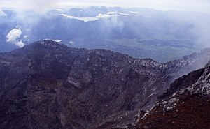
Tujuh volcano from Kerinci peak |
||
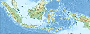
Tujuh , Indonesian Gunung Tujuh is a volcano on the Indonesian island of Sumatra in the Kerinchi-Seblat National Park in the Jambi province . It is located a few kilometers east of the Kerinci volcano .
The highest of its seven (Indonesian “tujuh”) peaks along the rim of the caldera is at an altitude of 2732 m . The crater is completely filled by an approximately 10 km², deep blue crater lake ( Danau Gunung Tujuh ), which is located at an altitude of 1996 m . This remote lake is still largely spared from human influences.
The mountain is densely forested up to the crater rim. The end of the ascent path is the crater rim at 2010 m directly at the outflow of the lake. The endangered tropical pitcher plant species Nepenthes aristolochioides is considered to be endemic to the Tujuh highlands.


