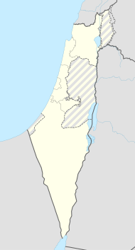
Kfar Warburg
| Kfar Warburg | ||
|---|---|---|
| Basic data | ||
| hebrew : | כְּפַר וַרְבּוּרְג | |
| State : |
|
|
| District : | south | |
| Founded : | October 31, 1939 | |
| Coordinates : | 31 ° 43 ' N , 34 ° 43' E | |
| Area : | 54 km² | |
| Residents : | 1142 (as of 2018) | |
| Population density : | 21 inhabitants per km² | |
| Community code : | 0320 | |
| Time zone : | UTC + 2 | |
| Postal code : | 83031 | |
| Website : | ||
|
|
||
Kfar Warburg (also Kefar Warburg, Hebrew: כְּפַר וַרְבּוּרְג, German: Dorf Warburg) is a large moshaw settlement in central Israel.
geography
The settlement is geographically next to Kirjat Mal'achi and has 98 farms and an area of approx. 6 km². The settlement is located in the Beér Tuvia regional council and is a member of the Moshavim movement. The moshav is about 40 km south of Tel Aviv and on expressway 3. In 2018, 1142 residents lived in the village.
history
The settlement was founded on October 31, 1939 by members of the Menachem organization. The settlement name was chosen in honor of Felix M. Warburg , a respected German-American figure in the Jewish community in the USA and founder of the American Jewish Joint Distribution Committee . Jigal Hurwitz's grave is in Kfar Warburg .
Known residents
- Jigal Hurwitz , multiple minister in Israel
Web links
- Official Website (Hebrew)
Individual evidence
- ↑ אוכלוסייה ביישובים 2018 (population of the settlements 2018). (XLSX; 0.13 MB) Israel Central Bureau of Statistics , August 25, 2019, accessed May 11, 2020 .
- ↑ אוכלוסייה ביישובים 2018 (population of the settlements 2018). (XLSX; 0.13 MB) Israel Central Bureau of Statistics , August 25, 2019, accessed May 11, 2020 .
