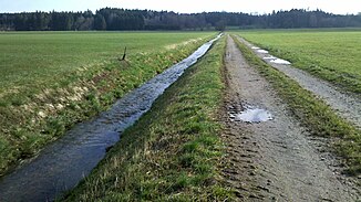
Kirchdorfer Bach
| Kirchdorfer Bach | ||
|
Kirchdorfer Bach before the confluence with the Moosbach (at the edge of the forest) |
||
| Data | ||
| Water code | DE : 182662 | |
| location | Upper Bavaria | |
| River system | Danube | |
| Drain over | Moosbach → Glonn → Mangfall → Inn → Danube → Black Sea | |
| Source height | 567 m | |
| muzzle |
Moosbach coordinates: 47 ° 53 '57 " N , 11 ° 55' 59" E 47 ° 53 '57 " N , 11 ° 55' 59" E |
|
| Mouth height | 498 m | |
| Height difference | 69 m | |
| Bottom slope | approx. 15 ‰ | |
| length | approx. 4.7 km | |
The Kirchdorfer Bach is the right upper course of the Moosbach in Upper Bavaria .
It arises near Oberwertach , flows in an easterly direction through Maxhofen and Kirchdorf am Haunpold and finally flows together with the Ginshamer Bach to the Moosbach.
