
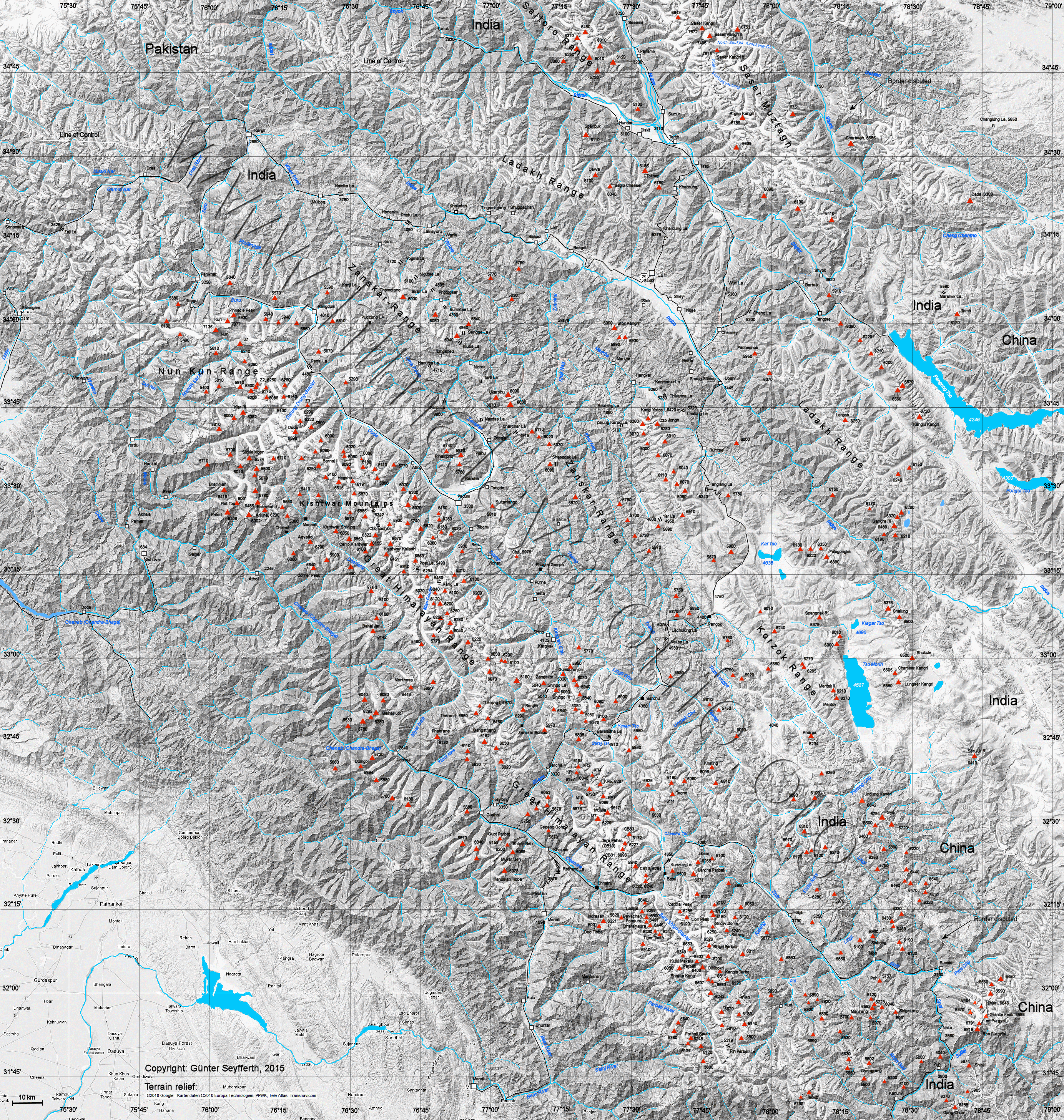
Kishtwar Himalayas
| Kishtwar Himalayas | |
|---|---|
 Drang-Drung-Glacier with Z3 in the background on the right |
|
| Highest peak | Sickle Moon ( 6574 m ) |
| location | Jammu and Kashmir , Ladakh , Himachal Pradesh ( India ) |
| part of | western himalayas |
| Coordinates | 33 ° 34 ′ N , 76 ° 10 ′ E |
| Type | Fold Mountains |
The Kishtwar Himalayas are part of the western Himalayas .
location
The Kishtwar Himalayas extend over part of the Indian union territories of Jammu and Kashmir and Ladakh as well as the state of Himachal Pradesh . The mountain range lies within the districts of Kishtwar , Kargil and Chamba . It is bounded in the south by the Chanab river valley , in the west by its tributaries Kiar Nal and Marau and in the east by the Myiar glacier and its outflow to the Chanab. The northern border is formed by the headwaters of the Zanskar - Stod ( Doda ) and Lungnak ( Tsarap ).
The Chanab tributary Dharlang flows through the central part of the Kishtwar Himalayas in a westerly direction. The mountain reaches a maximum height of 6574 m in the Sickle Moon . Most of the peaks are at an altitude of around 6000 m . A number of mountains (e.g. Cerro Kishtwar and Kishtwar Kailash ) offer difficult climbs that are challenging for the best climbers.
National parks
In the north of the Kishtwar district in Jammu and Kashmir is the Kishtwar National Park .
Web links
- Kishtwar Himalaya, Indian Himalayan Regions at indianetzone.com
- Kishtwar Himalaya at ari.rdx.net
- Map at himalaya-info.org