Klimov bluff
| Klimov bluff | ||
|---|---|---|
| location | Marie Byrd Land , West Antarctica | |
| part of | Jenkins Heights | |
|
|
||
| Coordinates | 74 ° 52 ′ S , 114 ° 2 ′ W | |
|
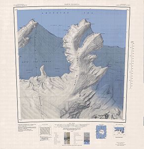
Topographic map (1: 250,000) of the Martin Peninsula with Klimov Bluff north of the Kohler Glacier (below) |
||
The Klimov Bluff is a partially ice-free and east-facing cliff on the Walgreen Coast of the West Antarctic Marie-Byrd Land . It rises 2.5 km southeast of Mount Bray at the southeast end of Jenkins Heights .
The United States Geological Survey mapped the cliff based on its own measurements and aerial photographs of the United States Navy from 1959 to 1966. The Advisory Committee on Antarctic Names named it in 1967 after the Soviet exchange scientist Lew W. Klimow, who in the Antarctic winter of 1966 at McMurdo Station was active and from 1966 to 1967 was part of the team that explored the Marie-Byrd-Land.
Web links
- Klimov Bluff in the Geographic Names Information System of the United States Geological Survey (English)
- Klimov Bluff on geographic.org (English)

