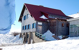
Klosterneuburger Hut
| Klosterneuburger Hut | ||
|---|---|---|
| location | Pölstal ; Styria , Austria | |
| Mountain range | Wölzer Tauern , Niedere Tauern | |
| Geographical location: | 47 ° 15 '54.5 " N , 14 ° 22' 43.2" E | |
| Altitude | 1902 m above sea level A. | |
|
|
||
| owner | formerly ÖGV , now private | |
| Built | 1929/30 | |
| Construction type | hut | |
| Development | Toll road | |
| accommodation | open | |
| Web link | klosterneuburgerhuette.com | |
| Hut directory | PES | |
The Klosterneuburger Hütte was an Alpine Club hut of the ÖGV at an altitude of 1902 m in the Wölzer Tauern in Styria , Austria . It was built in 1929/30 by the Klosterneuburg group of the Austrian Mountain Association . As an Alpine Club hut, according to the website, it last had 24 dormitories / beds and 20 places in the mattress dormitory.
The location of the hut is between the Tauernwindpark and the Lachtal ski area, community Schönberg-Lachtal , on the east side of the Schönberg ( 1943 m ) directly below the summit, which is easy to reach from the hut.
In June 2009 the house was sold by the Alpine Club and has been privately owned since then. The hut has been open all year round since July 2014.
Ascent
The following career opportunities are available:
- through the Zeiringgraben, walking time: 2 hours
- from the Lachtal, 1570 m , walking time: 1 hour
- from Oberzeiring , 932 m , walking time: 4 hours
- from Pusterwald , 1073 m , walking time: 3 hours
- from Oberzeiring 13.4 km via the asphalt "Höhenstraße" (Mitterlerer Karleiten Weg and Oberer Höhenweg), which at a certain height becomes a toll private road with automated barriers and is accessible from the beginning of April to the end of October.
- By car in 30 minutes
- By bike in 2:00 hours uphill (+ 1044 / -83 m) or 1:15 hours downhill
- On foot 3:45 hours up or 3:00 hours down
- in winter by ski with the drag lift from the Lachtal
Transitions to neighboring huts
- Brucker Hut ( 1605 m ), walking time: 1 hours
- Plannerhütte ( 1540 m ), walking time: 13 hours
- Lachtalhaus ( 1570 m ), walking time: 1 hours
- Oberzeiring ( 932 m ) via Hirzeck ( 1836 m ), walking time: 3 hours
summit
- High Zinken ( 2222 m ), walking time: 1 hour
- Schießeck ( 2275 m ), walking time: 1 hours
- Steineck ( 2260 m ), walking time: 3 hours
- Hühnerkogel ( 2242 m ), walking time: 3 hours

