Pinch
| Pinch | ||
|---|---|---|
|
Summit of the Kneiff |
||
| height | 560.08 m | |
| location | Canton of Clervaux , Grand Duchy of Luxembourg | |
| Mountains | Ösling , Ardennes | |
| Dominance | 11.9 km → Dackelscheidberg | |
| Coordinates | 50 ° 9 '26 " N , 6 ° 2' 13" E | |
|
|
||
| rock | slate | |
| particularities | Highest peak in the Grand Duchy of Luxembourg | |
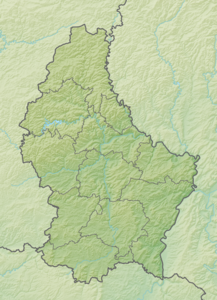
The hill Kneiff introduces 560.08 m the highest elevation of Luxembourg . It is located in the municipality Troisvièrges in the field of town Wilwerdange in the far north of the Grand Duchy, near the border with Belgium and is part of the Ardennes , the Ösling called . It is part of the Our Nature Park .
Only then does the Burgplatz (lux .: Buergplaz) near Huldingen follow at 559 m , which is often incorrectly referred to as the highest point, as the Kneiff is located in the middle of a conservation area and, in contrast to Burgplatz, is hardly developed for tourists.

