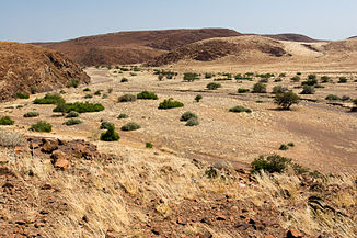
Koigab
| Koigab | ||
|
Riverbed |
||
| Data | ||
| location | Namibia | |
| River system | Koigab | |
| muzzle | in the Atlantic Coordinates: 20 ° 29 ′ 40 ″ S , 13 ° 16 ′ 7 ″ E 20 ° 29 ′ 40 ″ S , 13 ° 16 ′ 7 ″ E
|
|
| length | 130 km | |
| Catchment area | 2,320.891 km² | |
The Koigab is one of the twelve ephemeral dry rivers in western Namibia . The Koigab lies between Huab and Uniab and is 130 km long. Its name means "salty bush" and refers to the often dense stocks of salsola in the river bed.
Hydrology
The catchment area of the Koigab covers 2320.891 km² and extends from the mouth in the Atlantic east to Bergsig at the foot of the Grootberg . The highest point of the catchment area is 1570 m. The catchment area is mountainous and very arid , the precipitation is very sporadic and stays below 100 mm / a in the whole catchment area. There are several springs in the middle reaches, including some relatively important ones such as Springbokwater .
Vegetation and fauna
The catchment area of the Koigab is evenly distributed between the Mopane savannah and northern Namib . In contrast to the larger areas, there are practically no gallery forests , but the relatively high groundwater level and the springs offer not only the typical mopane bush, but also space for denser bush vegetation, which mainly consists of euclea , tamarisk ( Tamarix ), salvadora and salsola . Despite its small size and relatively small gallery vegetation, the koigab is also essential for the black rhinoceros and other game. Oryx and springbok can be found in the dense shrubbery .
Use and settlement
80% of the Koigab catchment area is in Communal Land , while the remaining 20% is in the Skeleton Coast Park area. The population is less than 100 and is concentrated around the Bergsig settlement , which is exclusively used for livestock farming. In terms of tourism, the Koigab is of little interest compared to Uniab , Hoanib and Hoarusib .
literature
- Mary Seely, Kathryn M. Jacobson, Peter J. Jacobson: Ephemeral Rivers and Their Catchments - Sustaining People and Development in Western Namibia . Desert Research Foundation of Namibia, 1995, ISBN 978-99916-709-4-2 .
- Klaus Hüser, Helga Besler, Wolf Dieter Blümel, Klaus Heine, Hartmut Leser, Uwe Rust : Namibia - A Landscape Studies in Pictures . Klaus Hess, Göttingen / Windhoek 2001, ISBN 978-3-933117-14-4 .
Individual evidence
- ↑ Mapping the Major Cathments of Namibia. Ben Ben J. Strohbach, National Botanical Research Institute, pp. 5-6.
