Kolkingehoog
| Kolkingehoog | ||
|---|---|---|
|
Kolkingehoog |
||
|
|
||
| Coordinates | 54 ° 51 '26.3 " N , 8 ° 22' 50" E | |
| place | Archsum, Schleswig-Holstein , Germany | |
| Emergence | between 3500 and 2800 BC Chr. | |
| height | 0 m | |
| Sprockhoff no. | 9 | |
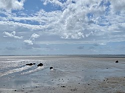
The remains of the Kolkingehoog large stone grave are located south of Archsum on the island of Sylt , so they belong to the district of North Friesland in Schleswig-Holstein . It is located on the lake side of the dike , about 1000 meters southeast of the Merelmerskhoog .
The stones of the grave become visible at low tide , it lies in the tidal flats and is therefore exposed to destruction by the North Sea . The position of the stones has changed a lot due to the constant interference of the sea, and so the original burial chamber can no longer be recognized.
In Ernst Sprockhoff's "Atlas of Germany's Megalithic Tombs" the large stone grave is listed as "Sprockhoff 9". The megalithic system of the funnel beaker culture (TBK) was created between 3500 and 2800 BC. Chr.
See also
literature
- Ernst Sprockhoff : Atlas of the megalithic tombs of Germany - Schleswig-Holstein. Rudolf Habelt, Bonn 1966, p. 4.

