Koller plan
The Koller Plan was a plan developed between 1937 and 1938 to rebuild the city of the KdF car near Fallersleben , today's Wolfsburg . Because of the Second World War , it was only implemented to a small extent. The plan is named after its creator Peter Koller .
history
prehistory
The Austrian architect Peter Koller (1907–1996) was appointed by General Building Inspector Albert Speer to be responsible for building the city at the Volkswagen factory , which was founded in 1938. The aim was to build an "exemplary German workers town". Reich Chancellor Adolf Hitler expected "a training center for both urban architecture and social settlements".
The actual Koller plan was described by its creator as a “jumping horse” because of its shape on maps. In addition, Koller created the plans "Variant A" and "Variant B", which, as he later stated, were deliberately designed in such a way that they were rejected due to excessive symmetry and failure to observe the geographical conditions. An alternative plan by the three Braunschweig professors E. Herzig, L.-H. Fiesche and F. Gerstenberg envisaged a city axis aligned with the Volkswagen plant with three monumental squares and six residential quarters aligned with them. For this purpose, parts of the Klieversberg should be removed.
The Koller Plan was presented to Hitler by Speer and, with some changes, approved by Hitler on March 2, 1938.
The Koller plan
The plan was shaped by the Athens Charter , passed in 1933, one of the aims of which was to separate workplaces from natural residential areas. Koller's plan called for expansion stages for 30,000, 60,000 and 90,000 residents. A population of 400,000 was also checked.
A “town crown” was planned on the approximately 110 meter high Klieversberg southwest of the planned center, around 50 meters above the Volkswagen factory. In contrast to Bruno Taut's concept of a city crown propagated in 1919, there should be monumental party buildings surrounded by a bastion-like wall.
The city map was based on the approximately 1,300-meter-long front of the Volkswagen factory and the Mittelland Canal running parallel to it . At the foot of the Klieversberg a 1500 meter long boulevard was planned, on which the town hall should be located. Two main axes should lead to the two entrances to the Volkswagen factory. In contrast to what Koller had planned, the plan contained numerous district squares. The existing villages of Heßlingen and Rothenfelde with a total of almost 1000 inhabitants were to remain.
The newly built districts should be connected by a network of paths that should be separated from the road network. The main streets should be 60 to 100 meters wide.
As is usual with Nazi urban planners, Koller cities should be divided into manageable neighborhoods. In order to be able to determine the appropriate size and equipment of the settlements, these architects used social statistical data from which they believed they could derive the ideal dimensions for urban planning units. The small settlement units were to be separated by wide green belts. This design was definitely influenced by the garden city movement. Koller's planning identified around five percent of the area as recreational greenery that was to be connected to cycling and hiking trails. First and foremost, the loosened structures should prevent a repolarization of the workforce and a possible revival of communist ideas. In addition, the plan was compatible with air protection concepts against bomber attacks. A division of the city into six local NSDAP groups was supposed to facilitate the control of the population. With the crowning of the city, on the mountain and thus at the central and highest point, the omnipotence of the Nazi system was to be projected into the homeland security settlements - which were geared towards urban planning. The discipline desired by the planners accompanied the planning from the start. This should be concealed by the creation of a "felt national community". For this purpose, planned events were planned, for example with marches on the broad city axes and the large squares connected to them.
Koller's plan provided for a decidedly urban character for the inner city areas. Housing construction was subordinated to the needs of industry. It should be inexpensive and quick to pull up, with shorter journeys to the workplace and tenements for the workers.
execution
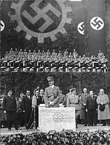
On May 26, 1938, Hitler laid the foundation stone for the construction of the Volkswagen factory. Construction of the city began at the same time.
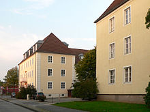
On June 1, 1938, the Gezuvor (Society for the Preparation of the German Volkswagen) opened a city planning office, of which Koller became the head. On July 1, 1938, the city of the KdF car was founded near Fallersleben . The first residential quarters Steimker Berg (for engineers and other high-ranking employees) and Wellekamp and Schillerteich for workers were built according to the specifications of the Koller plan. Only around a hundred meters of the boulevard were built. The centrally located Tullio Cianetti Hall served as the meeting place .
In autumn 1942, further execution of the Koller Plan came to a standstill due to the war. At this point in time around 3,000 apartments had been completed. Koller himself was drafted into military service.
After the end of the war, new urban development plans were drawn up, partly with the help of Koller. The main shopping street Porschestrasse , built in 1951, corresponds to the eastern main axis planned by Koller. The former boulevard is now called Klieverhagen and is mainly used as a parking area. A “city crown” was not erected.
Web links
- Tobias Schiller: Wolfsburg - the "city of the KdF car". (PDF)
- Illustration of the Koller plan at thoemmes-wittig.de
- Image documents from the founding phase of the city at postautomation.de
Individual evidence
- ^ A b c Nicole Froberg, Ulrich Knufinke, Susanne Kreykenboom: Wolfsburg. The architecture guide. Braun Publishing, Berlin 2011, ISBN 978-3-03768-055-1 , p. 32.
- ^ A b c d Tobias Schiller: Wolfsburg - The "City of the KdF-Wagens". (PDF), accessed on March 26, 2016
- ^ A b Nicole Froberg, Ulrich Knufinke, Susanne Kreykenboom: Wolfsburg. The architecture guide. Braun Publishing, Berlin 2011, ISBN 978-3-03768-055-1 , p. 33.
- ↑ 2400 apartments for 1939. Aller-Zeitung of April 27, 1938. In: City of Wolfsburg (ed.): 50 years of Wolfsburg in the mirror of the press. City of Wolfsburg, Wolfsburg 1988, p. 7.
- ↑ Marcel Glaser, Manfred Grieger : The "City of the KdF car near Fallersleben". A model room of the National Socialist national community? In: Malte Thießen, Winfried Suss (ed.): Cities under National Socialism: Urban spaces and social orders. Wallstein Verlag, 2017, pp. 127–144.


