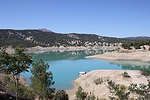
Korkuteli
| Korkuteli | ||||
|
||||

|
||||
| Basic data | ||||
|---|---|---|---|---|
| Province (il) : | Antalya | |||
| Coordinates : | 37 ° 4 ' N , 30 ° 12' E | |||
| Residents : | 25,515 (2017) | |||
| Telephone code : | (+90) 242 | |||
| Postal code : | 07 800 | |||
| License plate : | 07 | |||
| Structure and administration (status: 2018) | ||||
| Mayor : | Hasan Ali İrban | |||
| Website: | ||||
| Korkuteli district | ||||
| Residents : | 53,610 (2017) | |||
| Surface: | 2,536 km² | |||
| Population density : | 21 inhabitants per km² | |||
| Kaymakam : | Erkan Karahan | |||
| Website (Kaymakam): | ||||
Korkuteli is a city in Turkey about 60 km northwest of Antalya and the capital of the Korkuteli district of the same name . It had 25,515 inhabitants at the end of 2017.
The Korkuteli Dam is on the western edge of the city .
etymology
The name comes from Korkud , an Ottoman prince who was captured here in a nearby cave and later murdered on the orders of his brother Selim I.
Korkuteli is twin town of the Polish city of Jarocin .
Attractions
Individual evidence
- ↑ a b c Citypopulation , accessed on October 17, 2018


