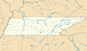
Cumberland Power Station
| Cumberland Power Station | |||
|---|---|---|---|
| location | |||
|
|
|||
| Coordinates | 36 ° 23 '29 " N , 87 ° 39' 17" W | ||
| country | United States | ||
| Waters | Cumberland River | ||
| Data | |||
| Type | coal-fired power station | ||
| Primary energy | Fossil energy | ||
| fuel | Hard coal | ||
| power | 2470 MW electric | ||
| owner |
|
||
| Start of operations | 1973 | ||
| Chimney height | 305 m | ||
The power plant Cumberland is a coal fired power plant of the Tennessee Valley Authority (TVA) near Cumberland City in the US state of Tennessee .
It is located on the Cumberland River and has a total installed capacity of 2,470 megawatts (MW), making it the TVA's most powerful power plant.
The world's first turbine with an output of 1,300 MW was installed in the Cumberland power plant . It is a cross-compound turbine with two shaft trains, one double-flow high and medium pressure turbine and four double-flow low pressure turbines.
blocks
| block | Performance (gross) | Installation | Steam generator |
|---|---|---|---|
| 1 | 1300 MW | March 1973 | Babcock & Wilcox |
| 2 | 1300 MW | November 1973 | Babcock & Wilcox |
Web links
Commons : Kraftwerk Cumberland - Collection of images, videos and audio files
Individual evidence
- ^ TVA: Cumberland Fossil Plant
- ^ Karl Strauss: Thermal power plants from the beginning in the 19th century to the final phase of their development . Springer-Verlag, 2016, ISBN 3-662-50537-1 , p. 118.
- ↑ a b Babcock & Wilcox Company Supercritical (Once Through) Boiler Technology ( Memento of the original from October 14, 2016 in the Internet Archive ) Info: The archive link was inserted automatically and has not yet been checked. Please check the original and archive link according to the instructions and then remove this notice. , May 1998


