Kremnick Mountains
| Kremnick Mountains | ||
|---|---|---|
|
Jastrabská skala in the Kremnick Mountains |
||
| Highest peak | Flochová ( 1318 m nm ) | |
| location | Slovakia | |
| part of | Western Carpathians | |
|
|
||
| Coordinates | 48 ° 40 ′ N , 19 ° 0 ′ E | |

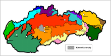
The Kremnitzer Mountains (Slovak Kremnické vrchy , Hungarian Körmöci-hegység ) are a low mountain range in Slovakia .
They belong to the course of the Western Carpathians and form part of the Slovak Central Uplands .
The area stretches east of the city of Kremnica (German: Kremnitz ), from which it gets its name, is largely covered by forest and well served by hiking trails.
The mountains, which are mostly at heights of 800 to 900 meters, are joined by the Great Fatra in the north , while they are bordered by the Hron valley in the east and south . One of the draining rivers is the Turiec .
Geomorphologically, it can be broken down as follows:
- Kunešovská hornatina (northwest)
- Jastrabská vrchovina (southwest)
- Flochovský chrbát (central and north)
- Turovské predhorie (south)
- Malachovské predhorie (east)
The highest point is the Flochová at 1318 meters above sea level.

