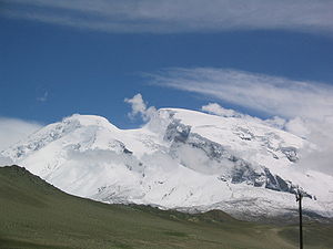
Kuksay Tagh
| Kuksay Tagh | ||
|---|---|---|
|
left Kuksay Tagh, right the Muztagata |
||
| height | 7184 m | |
| location | Circle Akto in the district Kizilsu in Xinjiang ( China ) | |
| Mountains | Muztagata massif ( Pamir ) | |
| Dominance | 2.17 km → Muztagata | |
| Notch height | 309 m ↓ ( 6875 m ) | |
| Coordinates | 38 ° 17 '42 " N , 75 ° 7' 21" E | |
|
|
||
| First ascent | August 7, 1981 by a Japanese expedition | |
The Kuksay Tagh (or short: Kuksay ; also Muztagh Ata II ) is a 7184 m high glaciated mountain in the eastern Pamir Mountains in Xinjiang ( PR China ).
The Kuksay Tagh is located in the county Akto in Kyrgyz Autonomous County Kizilsu . The 7184 m high Kuksay Tagh rises 2.17 km north-northeast of the 7509 m high Muztagata . Due to a notch height of only 309 m, the Kuksay Tagh is not considered a separate mountain. The Kuksay Glacier flows on its eastern flank . The westward flowing Kmatolya glacier separates the Kuksay Tagh from the Muztagata.
Ascent history
The first ascent was made on August 7, 1981 by Tadakiyo Sakahara and Kimiharu Matsui, participants in a Japanese expedition.
Web links
Commons : Kuksay Tagh - collection of images, videos and audio files
- Kuksay, China on Peakbagger.com (English)
Individual evidence
- ↑ Asia, China, Mustagh Ata . American Alpine Journal, 1982, vol. 24.

