Læsø Rende Fyr
| Læsø Rende Fyr | ||
|---|---|---|
| The lighthouse in the Dvalegrunden | ||
| Location: | North Jutland , Denmark | |
| Geographical location: | 57 ° 13 '8.1 " N , 10 ° 40' 23.3" E | |
| Height of tower base: | 0 m | |
| Fire carrier height : | 27.50 m | |
| Fire height : | 26 m | |
|
|
||
| Identifier : | Fl (2) HR | |
| Scope knows: | 18 nm (33.3 km ) | |
| Scope green: | 14 nm (25.9 km ) | |
| Scope red: | 14 nm (25.9 km ) | |
| Construction time: | 1965 | |
| International ordinal number: | C 0061.0 | |
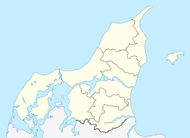
The Læsø Rende Fyr ( German lighthouse Læsø Rende ) is a Danish lighthouse in the Kattegat between the island of Vendsyssel-Thy and the island of Læsø . It belongs to the municipality of Læsø and warns of the shallows of the southeastern Dvalegrunden.
history
Eight kilometers from the west coast of the island of Læsø, the 27.5 meter high steel mast was erected in 1965 in a water depth of three meters. He replaced the Fyrskib No XV ( German lightship no. 15 ) , which was previously in service at approximately the same place between 1937 and the end of 1964.
There is a helicopter landing pad on the roof of the tower . In winter, the door of the lighthouse is often covered by an impenetrable layer of ice, so that direct access is only possible through the upper hatch of the lighthouse.
Web links
- Læsø Rende Fyr. In: visitlaesoe.dk. Retrieved October 11, 2019 (Danish).
- Læsø Rende Fyr, Kattegat, Denmark. In: Leuchtturm-web.de. Retrieved October 11, 2019 .
- Læsø Rende. Photo. Retrieved October 11, 2019 .
Individual evidence
- ↑ Dansk Fyrliste. (PDF) In: soefartsstyrelsen.dk. 2018, p. 75 , accessed on October 11, 2019 (Danish).

