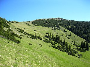
Lösertal head
| Lösertal head | ||
|---|---|---|
|
Lösertal head, south flank |
||
| height | 1859 m above sea level NHN | |
| location | Bavaria , Germany | |
| Mountains | Ammergau Alps | |
| Coordinates | 47 ° 33 '27 " N , 10 ° 52' 28" E | |
|
|
||
| rock | limestone | |
| Normal way |
Kenzenhütte - Maximiliansweg - West Ridge - Lösertalkopf |
|
The Lösertal head is a little more pronounced 1859 m above sea level. NHN high summit in the Ammergau Alps .
location
Within the Ammergau Alps, the Lösertalkopf belongs to the high plateau group . The summit is the highest point in the connecting ridge between the Hochplatte and Scheinbergspitz . To the north, the Lösertalkopf is connected to the Vorderscheinberg via the Lösertaljoch .
summit
The summit can be reached without difficulty via the southwest ridge. The south side below the summit consists of moderately steep meadows interspersed with mountain pines . During the summer season, the summit of the Lösertaljoch can be climbed through the partly rocky northern flank. As part of a ski tour, the summit is climbed from the Lösertalmösl in spring and winter through the steep trough on the northeast side.
Summit panorama
literature
- Area map UK L 10 of the Bavarian State Office for Surveying 2007
Individual evidence
- ↑ Federal Office for Cartography and Geodesy , State Office for Surveying and Geoinformation Bavaria : Digital Topographical Map 1:25 000, [1] , accessed on January 9, 2016
- ↑ Dieter Seibert: Alpine Club Guide Ammergau Alps, Bergverlag Rudolf Rother, Munich, 2nd edition 1982, page 99


