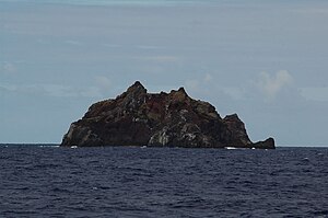
L'Esperance Rock
| L'Esperance Rock | |
|---|---|
| L'Esperance Rock as seen from the northeast | |
| Waters | Pacific Ocean |
| Archipelago | Kermadec Islands |
| Geographical location | 31 ° 26 ′ 0 ″ S , 178 ° 54 ′ 0 ″ W |
| length | 300 m |
| width | 180 m |
| surface | 4.8 ha |
| Highest elevation | 70 m |
| Residents | uninhabited |
| Map of the Kermadec Islands, L'Esperance in the far south | |
L'Esperance Rock is a small, uninhabited island of volcanic origin in the southwestern Pacific Ocean . It is the southernmost island of the Kermadec Islands administered by New Zealand and is located around 80 km south-southwest of Curtis Island . It is a good 600 km away from the East Cape on the North Island of New Zealand.
The up to 70 m high island has a maximum diameter of 250 m and has an area of 4.8 ha (0.048 km²). 8 km northwest of L'Esperance Rock is Havre Rock, which barely rises above the sea surface .
The island was discovered by the French navigator Jean-Michel Huon de Kermadec on March 16, 1793 as part of the expedition Joseph Bruny d'Entrecasteaux '; it is named after his research vessel L'Esperance .
The radius of 12 nautical miles around the island is part of the 7450 km² Kermadec Islands Marine Reserve, which is administered by the Department of Conservation . The island can therefore only be entered with a permit and only for scientific purposes.
Web links
- L'Esperance Rock at seafriends.org.nz (English)

