La Trinidad (Nicaragua)
| La Trinidad | ||
|---|---|---|
|
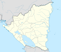
Coordinates: 12 ° 58 ′ N , 86 ° 14 ′ W La Trinidad on the map of Nicaragua
|
||
| Basic data | ||
| Country | Nicaragua | |
| Department | Estelí | |
| City foundation | 1967 | |
| Residents | 11,000 (2005) | |
| Detailed data | ||
| surface | 270 km 2 | |
| Population density | 41 people / km 2 | |
| height | 610 m | |
| Time zone | UTC −6 | |
La Trinidad is a city in Nicaragua with about 11,000 inhabitants. It is located about 120 km north of the capital Managua and about 25 km southeast of Estelí in the Estelí department .
La Trinidad is located in the mountainous highlands at an altitude of about 600 meters. There are a number of extinct volcanoes in the region . The place is framed by three mountains (Oyanca, La Mocuana, El Atillo). A large number of smaller villages belong to the municipality , so that the population has a total of over 20,000 inhabitants. La Trinidad is located directly on the Panamericana and is therefore easy to reach by car and bus. Often only narrow, non-passable footpaths lead to the decentralized districts . The place has a hospital, a central library and around 40 decentralized schools.
The region's main sources of income are agriculture (maize, beans, vegetables) and the bakery trade. There is a bread factory. The farms are partially affected by drought caused by El Niño . Part of the population works in Estelí due to a lack of local jobs .
Town twinning
- Moers , Germany, since 1989
