Lac Chavigny
| Lac Chavigny | ||
|---|---|---|
| Geographical location | Québec (Canada) | |
| Tributaries | Rivière Innuksuac | |
| Drain | Rivière Innuksuac | |
| Data | ||
| Coordinates | 58 ° 12 ′ N , 75 ° 13 ′ W | |
|
|
||
| Altitude above sea level | 162 m | |
| surface | 262 km² | |
| length | 45 km | |
| width | 14 km | |
The Lac Chavigny is a lake in Nunavik in northern Administrative Region Nord-du-Québec in the Canadian province of Quebec .
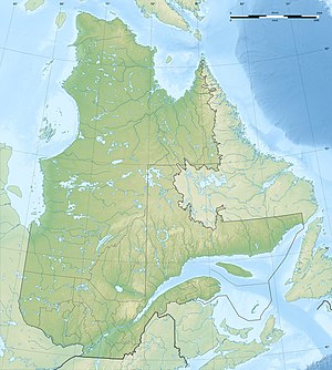
The lake is located 120 km east of Hudson Bay and 100 km north of Lac Minto in the northwestern part of the Labrador Peninsula . It is located in the area of the Canadian Shield at an altitude of 162 m . The Lac Chavigny has an area of 262 km². It has a north-south extension of 45 km, the width is 14 km. The lake is crossed by the Rivière Innuksuac in a northerly direction. The elongated peninsula Presqu'île Qikirtaujaaluk protrudes to the west in the northern part of the lake .
In 1951 the lake got its name in memory of the explorer François de Chavigny Lachevrotière (1650-1725).
Individual evidence
- ↑ a b c d Commission de toponymie du Québec - Lac Chavigny
