Lac Matagami
| Lac Matagami | ||
|---|---|---|

|
||
| Geographical location | Jamésie , North du Québec in Québec (Canada) | |
| Tributaries |
Rivière Allard , Rivière Bell , Rivière Gouault , Rivière Waswanipi |
|
| Drain | Rivière Nottaway | |
| Location close to the shore | Matagami | |
| Data | ||
| Coordinates | 49 ° 52 ′ N , 77 ° 27 ′ W | |
|
|
||
| surface | 236 km² | |
| length | 43 km | |
| width | 14 km | |
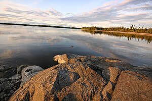
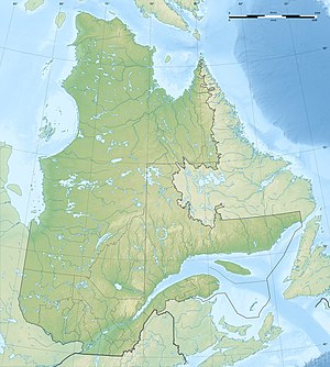
The Lake Matagami is a 236 km² large lake in Canada , in the regional county municipality Jamesie (Administrative Region Nord-du-Québec ) in Québec .
The city of Matagami is a few kilometers south of the lake.
geography
The lake is located in a swampy region in northern Québec. It is fed by several rivers including the Allard , Bell , Gouault and Waswanipi . The lake reaches a width of 14 km and a length of 43 km.
history
Lac Matagami was used by the Hudson's Bay Company as a transportation route for the fur trade for a long time between the 18th and 20th centuries .
Origin of name
In the language of the Cree , matagami means something like "meeting of the waters", a reference to the larger rivers that flow into the lake.
Web links
Commons : Lac Matagami - Collection of images, videos and audio files
Individual evidence
- ↑ a b c d Commission de toponymie Québec - Lac Matagami
