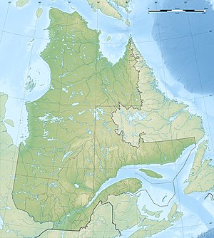
Lac Payne
| Lac Payne | ||
|---|---|---|
| Geographical location | Nunavik , North du Québec in Québec (Canada) | |
| Tributaries | Rivière Tassialouc , Rivière Breslay , Rivière Loubet | |
| Drain | Rivière Arnaud | |
| Data | ||
| Coordinates | 59 ° 27 ′ N , 74 ° 0 ′ W | |
|
|
||
| Altitude above sea level | 130 m | |
| surface | 508 km² | |
| length | 103 km | |
| width | 12 km | |
Lac Payne is a lake on the Ungava Peninsula in the Nunavik region of the Canadian province of Québec .
The lake has a length of 103 km and is up to 12 km wide. It is 130 m above sea level. Its water area is 508 km². The total area including islands is 533 km². Lac Payne is fed by Lake Tassialouc to the south and Lac du Pélican to the north . Lac Payne itself is drained by the Rivière Arnaud river in an easterly direction towards Ungava Bay .
Web links
Individual evidence
- ↑ a b Natural Resources Canada - The Atlas of Canada - Lakes ( Memento from January 14, 2013 in the Internet Archive )
- ↑ a b c Commission de toponymie du Québec - Lac Payne
