Lac Tassialouc
| Lac Tassialouc | ||
|---|---|---|
| Geographical location | Nunavik , North du Québec in Québec (Canada) | |
| Drain | Rivière Tassialouc | |
| Data | ||
| Coordinates | 59 ° 4 ′ N , 73 ° 54 ′ W | |
|
|
||
| Altitude above sea level | 174 m | |
| length | 20 km | |
| width | 15 km | |
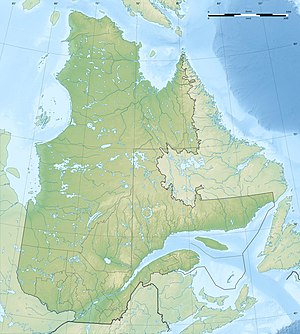
The Lac Tassialouc is a lake in the north of the Canadian province of Quebec .
Lac Tassialouc is located 40 km south of Lac Payne in the southern central part of the Ungava Peninsula . The lake is in the area of the Canadian Shield at an altitude of about 174 m . The Rivière Tassialouc drains the lake on its north bank and flows north to Lac Payne. The island-rich lake has a length of 20 km and a width of 15 km.
The name Tassialouc comes from the Inuktitut language and means "big lake".
