Chambon dam
| Lac du Chambon | |||||||
|---|---|---|---|---|---|---|---|
|
|||||||
|
|
|||||||
| Coordinates | 45 ° 2 '31 " N , 6 ° 8' 53" E | ||||||
| Data on the structure | |||||||
| Lock type: | Gravity dam | ||||||
| Construction time: | 1929-1934 | ||||||
| Height above valley floor: | 90 m (?) | ||||||
| Height above foundation level : | 136.7 m | ||||||
| Building volume: | 415 000 m³ | ||||||
| Crown length: | 293.6 m | ||||||
| Crown width: | 5 m | ||||||
| Data on the reservoir | |||||||
| Altitude (at congestion destination ) | 1040 m | ||||||
| Water surface | 1.4 km² | ||||||
| Storage space | 54 million m³ | ||||||
| Dam wall | |||||||
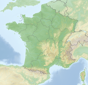
The Chambon dam (French Barrage du Chambon ) dams the Romanche river to Lac du Chambon near Le Chambon in the French Isère department in the Auvergne-Rhône-Alpes region . The dam, built from 1929 to 1934, was the highest dam in the world until the completion of the Hoover Dam in 1936 and the highest in Europe for 16 years until the Santa Giustina dam was built in 1950 .
The purpose of the impoundment was to operate a hydroelectric power station. The reservoir is 140 hectares and holds 54 million cubic meters. The impoundment began on April 24, 1935. The villages of Le Chambon, Le Dauphin and Le Parizet disappeared under the water.
The owner and current operator was Électricité de France , the construction work was carried out by Campenon Bernard .
There are two other reservoirs called "Chambon" in France, namely in the Puy-de-Dôme and Creuse departments .
See also
- List of the largest dams on earth
- List of the largest reservoirs on earth
- List of the largest hydroelectric plants in the world
- List of dams in the world


