Lac la Martre
| Lac la Martre | ||
|---|---|---|
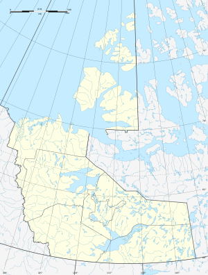
| Geographical location | Northwest Territories (Canada) | |
| Tributaries | Rivière Grandin | |
| Drain | Rivière la Martre → Marian River → Great Slave Lake | |
| Islands | Big Island | |
| Places on the shore | Whatì | |
| Location close to the shore | Yellowknife | |
| Data | ||
| Coordinates | 63 ° 15 ′ N , 117 ° 55 ′ W | |
|
|
||
| Altitude above sea level | 265 m | |
| surface | 1 687 km² | |
| length | 70 km | |
| width | 30 km | |
| Catchment area | 13,900 km² | |
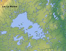
Lac la Martre is the third largest lake in the Northwest Territories of Canada . It is located northwest of the Great Slave Lake . The lake is 265 m above sea level. Its water area is 1687 km², including islands, the total area is 1776 km². The place whatI located on the southeastern shore of the lake. The lake is drained from the Rivière la Martre east to the Marian River , a tributary of the Great Slave Lake. The administrative center of the Northwest Territories, Yellowknife , is 160 km to the southeast.
Individual evidence
- ↑ a b The Atlas of Canada - Lakes ( Memento from January 14, 2013 in the Internet Archive ) (English)
- ↑ R-ArcticNet
- ↑ Natural Resources Canada - Geographical Names of Canada - Lac la Martre ( page no longer available , search in web archives ) Info: The link was automatically marked as broken. Please check the link according to the instructions and then remove this notice.

