Great slave lake
|
Great Slave Lake Great Slave Lake, Grand lac des Esclaves |
||
|---|---|---|

|
||
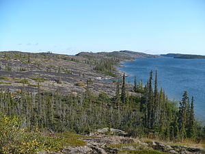
| Eastern arm of the Great Slave Lake | ||
| Geographical location | Northwest Territories ( Canada ) | |
| Tributaries | Slave River , Hay River , Lockhart River , Taltson River , Yellowknife River , Frank Channel , Buffalo River , Little Buffalo River , La Loche River | |
| Drain | Mackenzie River | |
| Places on the shore | Yellowknife , Fort Resolution | |
| Data | ||
| Coordinates | 61 ° 41 ′ N , 113 ° 53 ′ W | |
|
|
||
| Altitude above sea level | 156 m | |
| surface | 27,048 km² | |
| length | 480 km | |
| width | 109 km | |
| volume | 1580 km³ | |
| scope | 3057 km | |
| Maximum depth | 614 m | |
| Middle deep | 41 m | |
| Catchment area | 980,000 km² | |

|
||
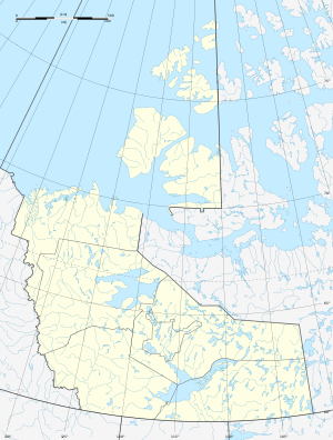
| Location of the Great Slave Lake in Canada | ||
The Great Slave Lake ( English Great Slave Lake ; French Grand lac des Esclaves ) is a lake in central northern Canada , in the Northwest Territories .
The lake has a water surface of 27,048 km². With the islands in it, the area is 28,568 km². With a maximum depth of 614 meters, the Great Slave Lake is the deepest lake in North America.
It is fed by the Slave River and the Hay River , among others . The Lockhart River flows into McLeod Bay in the far northeast of the lake, the Frank Channel drains Marian Lake into the North Arm , and the Taltson River flows into the lake east of the Slave River. The Mackenzie River , one of the largest rivers in North America, forms the drain of the Great Slave Lake . The main town on the largely sparsely populated lakeshore is Yellowknife .
The lake surface is 156 m above sea level, so that due to the extreme depth of the lake, the lake bed is up to 458 meters below sea level. Thus, the Great Slave Lake is a cryptodepression .
Origin of name
The name of the lake has nothing to do with slavery , but goes back to the name of an Indian tribe ( Slavey ) who settled in the area. The German translation of the name, like the French Esclave for slave, is a misunderstanding that has historically become commonplace. The name of the local tribe used to be reproduced phonetically as slave in English , but in modern times - especially to avoid the association with the term "slave" - this has been changed to Slavey . For the lake, however, the old name is still used unchanged in English.
Tributaries
- Slave river
- Hay River
- Lockhart River
- Frank Channel (Marian Lake Outflow)
- Taltson River
- Yellowknife River
Cities and settlements on the lake shore
See also
Web links
Individual evidence
- ↑ a b Natural Resources Canada - The Atlas of Canada - Lakes ( Memento from January 14, 2013 in the Internet Archive )
- ↑ Mackenzie River at the gauge at Fort Providence - hydrographic data from R-ArcticNET
