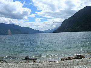
Lake Chapo
| Lake Chapo | ||
|---|---|---|

|
||
| Geographical location | Región de los Lagos ( Chile ) | |
| Data | ||
| Coordinates | 41 ° 27 ′ S , 72 ° 30 ′ W | |
|
|
||
| Altitude above sea level | 240 m | |
| surface | 55 km² | |
| length | 17 km | |
| width | 5 km | |
The Chapo Lake is a lake in southern Chile in the province of Llanquihue in the Los Lagos Region .
The lake is 150 km southwest of Puerto Varas , 43 km northwest of Puerto Montt . It is located immediately southeast of the Calbuco volcano and south of Lake Llanquihue with its national park. South of the lake is the Alerce Andino National Park .
The lake is 55 km², a maximum of 17 km long and 5 km wide; it is located at 240 m above sea level. NN and the water temperature fluctuates between 9 ° C in winter and 18 ° C in summer. The water level in the lake fluctuates due to the operation of the Canutillar power station .
There are water sports and fly fishing opportunities . a. on the rainbow trout . The Reloncaví estuary takes on the outflow of the lake .
