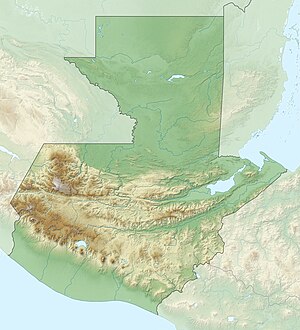
Lake Atitlan
| Lake Atitlan | ||
|---|---|---|

|
||
| Oblique view from space | ||
| Geographical location | Guatemala | |
| Drain | none | |
| Location close to the shore | Panajachel | |
| Data | ||
| Coordinates | 14 ° 42 ′ N , 91 ° 12 ′ W | |
|
|
||
| Altitude above sea level | 1560 m | |
| surface | 126 km² | |
| length | 18 km | |
|
particularities |
located in a caldera |
|
The Lago de Atitlán is the second largest lake in Guatemala . It is located in the department of Sololá and is known for its fauna and flora .
General
The lake has an area of 130 km², is approx. 18 km long from east to west and is approx. 1560 meters above sea level . It is surrounded by the three volcanoes Tolimán , Atitlán and San Pedro . Around the lake there are smaller settlements, hotels and the Sololá region . Most of the residents of the lake are indigenous ( Maya ), in the north Cakchiquel (main town Sololá) and in the south Tzutuhil (main towns Santiago Atitlán and San Pedro la Laguna ). The most important city on Lake Atitlán is Panajachel . The water temperature fluctuates between 18 and 20 degrees Celsius depending on the season.
The Lago de Atitlán is the livelihood of many inhabitants of the surrounding villages, because it attracts many tourists due to its beauty and as a freshwater reservoir ensures continuous harvests and is also very rich in fish. The lake became a nature park in 1955 .
Surname
The name Atitlán comes from Nahuatl , which is not spoken here, but in central Mexico , where atitlan means "place with a lot of water" or "place in the middle of water" ( atl "water" and -titlan "in the middle"). The equivalent in the Tzutuhil language is Chiyá or Chi 'Ya' , which is also the old name of the ruins of Chuitenamet (Chuitinamit) near San Pedro. Atitlán, on the other hand, refers to the place Santiago Atitlán . It is not known when the Nahuatl names introduced by the Spaniards through the mediation of the allied Tlaxcalteks superseded the old Tzutuhil names.
Emergence
The lake is located in a crater ( caldera ) that was created by the explosion of a very large volcano . Over time, the lake's water level has risen as the valley has no natural drainage. The deepest point of the old crater rim is in the southeast at San Lucas Tolimán. Since an earthquake in 1976, the water level has sunk by more than 10 m (as of July 2006).
Domestic animals
The puma is native to the lake , but it is considered rare. The Atitlan diver ( Podilymbus gigas ) that used to live here has been extinct since 1989 due to the release of non-native fish and the increasing population .
climate
The climate is stable all year round. Precipitation is rare as the Pacific clouds rain down on the western slopes of the volcanoes.
Strong winds that occur regularly on the lake are called Xocomil . According to legend, it is an unfortunate prince who is looking for his lover, who was killed on a boat trip on the lake.
literature
- Frank Herrmann: Guatemala, Stefan Loose Verlag ISBN 3-922025-92-7
- Ann Esswein: Abuelita is sick . taz , April 8, 2019 ( taz.de ).
Web links
- Lago de Atitlán in the Global Volcanism Program of the Smithsonian Institution (English)
- Angelika Franz: Maya pilgrimage site - treasure in the volcanic lake on Spiegel Online from December 21, 2009
- Web Community: Lake Atitlan Community
- Lago de Atitlan on volcano fascination
Individual evidence
- ^ Charles H. Long: Introduction: Entering the Atiteco World of Santiago Atitlan . In: James Vincent Stanzione, Paul Harbaugh, Angelika Bauer: Rituals of Sacrifice: Walking the Face of the Earth on the Sacred Path of the Sun . University of New Mexico Press, Albuquerque 2003. p. 1.


