Department of Sololá
| Sololá | |
|---|---|
| Location of Sololá in Guatemala | |
| Data | |
| Capital | Sololá |
| population | 505,500 (Ber. 2016) |
| surface | 1,061 km² |
| Population density | 476 inhabitants / km² |
| Highest elevation | Sierra Panimaquín (3,700 m) |
| ISO 3166-2 | GT-SO |
| Website | Inforpressca.com |
| Coat of arms of the Department of Sololá | |
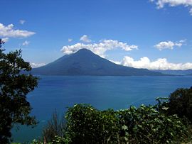
| San Pedro volcano | |
| Lake Atitlán panorama | |
Sololá is a department of Guatemala and is located in the southwest of the country (Region VI). It extends over 1,000 square kilometers and has just under 505,500 inhabitants. The capital of the department is Sololá of the same name .
The department of Sololá borders on Quiché to the northeast, Chimaltenango to the east, Suchitepéquez to the south, Quetzaltenango to the west and the Totonicapán department to the northwest .
National nature
Sololá is mainly located in the central highlands. In the center of the department lies the Atitlán Lake , one of the most beautiful lakes in America, at 1,562 m . It is surrounded by volcanoes and mountains of the Sierra Madre de Chiapas , which are up to 3,500 meters high. In the south, the department slowly descends from the volcanoes Atitlán and San Pedro as well as from the Sierra Panimaquín to the Pacific coast. Due to the differences in altitude, there are different climatic regions with species-rich flora and fauna. In Sololá, warm Pacific air often meets cold highland winds , which leads to falling winds ( Xocomil ) at Lake Atitlán , which can cause high waves, especially in the afternoon.
population
Three Maya ethnic groups have lived around Lake Atitlán for a long time : the Quiché , the Cakchiquel and the Tzutuhil . The people of these groups usually speak Spanish as well as their own Mayan languages . The indigenous people and the rest of the population live in nineteen Municipios ( large communities or districts ):
As a state administrative district , the department is headed by a governor sent by the central government . The Municipios are independent regional authorities with elected mayors and representatives of the people and are subdivided into Aldeas (rural communities) and Caseríos, Parajes or Fincas ( hamlets and farms ).
economy
Thanks to the fertile volcanic soil, agriculture is very pronounced, which has had an adverse effect on the cloud forests, especially in the last few decades. Mainly coffee , corn , avocados and black beans are produced . Handicrafts also play a role, with individual villages on the lake specializing in certain products (boats, ropes, textiles). The most important branch of the economy, however, is tourism, which has its center in Panajachel (also known as " Gringotenango ").
The relatively small department of Sololá is not well developed for traffic everywhere. In the far north it is crossed by the Interamericana (CA-1), which reaches its highest point (3,670 m) on the border with the Totonicapán Department . At El Cuchillo (Los Encuentros) a road branches off to the capital Sololá and to Panajachel, from where there is a connection along the east bank to San Lucas Tolimán and on to the Pacific.
Attractions
The most famous tourist attraction of the department is Lake Atitlán and the surrounding villages and mountains. Not far from the hotels in Panajachel, on the road to Sololá, is the Valle de San Buenaventura , a 100 hectare nature reserve. Here you can admire a variety of butterflies and orchids , among other things . From Panajachel there is a boat connection to Santiago Atitlán on the south side of the lake. The place is at the foot of the volcanoes Atitlán (3,557 m), Tolimán (3,158 m and 3,134 m) and San Pedro (3,020 m), on which various hiking trails lead.
history
Pedro de Alvarado conquered the area around Lake Atitlán in 1524 by playing off the warring Cakchiquel and Tzutuhil against each other. In the decades that followed, the indigenous population almost died out due to epidemics that were brought in. In the colonial period, the area formed the center of the Corregimiento de Tzololá (Sololá) , the southern part belonged to the Corregimiento de Atitlán (Santiago Atitlán) . Sololá was raised to the department on November 4, 1825, but was part of the Estado de Los Altos , the so-called sixth state of the Central American Confederation , from 1838, 1840 and 1848 to 1849 . After the establishment of the El Quiché department in 1872, Sololá lost almost two thirds of its original territory. In the 1930s, the Guatemalan government added Lake Atitlán to the national road network. The economic consequence was that large landowners began to exploit the indigenous rural population as cheap labor. In the 1960s, Lake Atitlán was a port of call for the North American hippie movement. The lake and Sololá were not spared from the civil war . Tourism did not recover until the late 1980s.
The name of the department comes from the Mayan word Tzolohá , which means "elder water".
Web links
- Overview of the department (Spanish)
Coordinates: 14 ° 46 ′ N , 91 ° 11 ′ W


