Totonicapán Department
| Totonicapán | |
|---|---|
| Location of Totonicapán in Guatemala | |
| Data | |
| Capital | Totonicapán |
| population | 553,400 ( ber . 2016) |
| surface | 1,061 km² |
| Population density | 522 inhabitants / km² |
| Highest elevation | Sierra Panimaquín (3,700 m) |
| ISO 3166-2 | GT-TO |
| Website | Inforpressca.com |
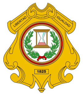
| Coat of arms of the Department of Totonicapán | |
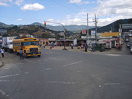
| Cuatro Caminos | |
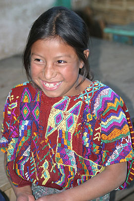
| Girls from the Momostenango area | |
Totonicapán is a department of Guatemala and is located in the southwest of the country (Region VI). It extends over 1,000 square kilometers and has just under 553,400 inhabitants. The capital of the department is the Totonicapán of the same name .
The department of Totonicapán borders in the north with the department Huehuetenango , in the east with Quiché , in the south with Sololá and in the west with Quetzaltenango .
National nature
Totonicapán is mainly located in the central highlands between about 2,000 and over 3,000 meters in altitude. The Guatemalan Sierra Madre runs through the south , sloping north to the valley of the Río Negro, behind which the Sierra de los Cuchumatanes rises in the neighboring departments of Huehuetenango and Quiché . Totonicapán is the coldest department in Guatemala. The originally extensive forest has been severely decimated. There are several hot water sources.
population
In Totonicapán live mainly Quiché - Maya . In addition to their own language, they also speak Spanish . The indígenas and the rest of the population live in eight municipalities ( large communities or districts ):
| Totonicapán | San Cristóbal Totonicapán |
| San Francisco El Alto | San Andrés Xecul |
| Momostanango | Santa María Chiquimula |
| Santa Lucía La Reforma | San Bartolo Aguas Calientes |
As a state administrative district , the department is headed by a governor sent by the central government . The Municipios are independent regional authorities with elected mayors and representatives of the people and are subdivided into Aldeas (rural communities) and Caseríos, Parajes or Fincas ( hamlets and farms ).
economy
The population lives mainly from agriculture. Corn , oats , wheat , beans , apples , plums and passion fruits are grown . Handicrafts and the production of textiles (woolen blankets from Momostenango) also play an important role .
The small department of Totonicapán is not well developed for traffic everywhere. In the southwest it is crossed by the Interamericana (CA-1), which reaches its highest point on the border with the Departamento Sololá (3,670 m). At San Cristóbal Totonicapán there is an important crossroads ( Cuatro Caminos ) from where you can reach the cities of Quetzaltenango and Totonicapán . The more sparsely populated north of the department still lacks a modern transport infrastructure.
Attractions
Totonicapán is not considered to be one of the major tourist destinations in Guatemala. For this reason, the original way of life of the highland Quiché can be reproduced here in a genuine way. The valley between Cuatro Caminos and the city of Totonicapán is known for its beautiful landscape and thermal springs. The capital of the department, founded by the Spanish in 1544, has a neoclassical theater and the neighboring church of San Miguel Arcángel . From the market town of San Francisco El Alto (2,630 m) there is a wide panorama of the surrounding mountains of the Sierra Madre. Momostenango, further north, is a Mayan religious center. At the sacrificial sites of Chit mesabal and Nim mesabal , Mayan priests and shamans perform their ancient rituals together with the rural population.
history
Totonicapán was a center of Quiché civilization before the arrival of the Spaniards. During the colonial period, the Maya population repeatedly revolted against the Spaniards. In 1816 they refused to pay taxes to the Spanish crown. In 1820 there was a rebellion led by Atanasio Tzul, who was then elected King of the Quiché, but had to give way to Spanish troops a few weeks later. Tzul, who was mayor of Totonicapán at the time, became a folk hero, after whom squares, streets, bridges and schools were later named. After independence from Spain, the area was elevated to a department in October 1825. However, between 1838 and 1849 it repeatedly joined the Estado de Los Altos , which was also referred to as the sixth state of the Central American Confederation .
The name of the department and its capital probably comes from the Maya word Totonilco , which means "hot water". According to another theory, it means "Vogelberg" ( totl - "Vogel", nica - "Berg", pan - place name suffix).
Individual evidence
- ^ John Baily: Central America; Describing Each of the States of Guatemala, Honduras, Salvador, Nicaragua, and Costa Rica . Trelawney Saunders, London 1850, p. 85.
Coordinates: 14 ° 55 ′ N , 91 ° 30 ′ W


